
11 min walk
Tank Hill
- Notable
- Nature site
Historic monument · San Francisco
| Monday | 05:00 – 00:00 |
|---|---|
| Tuesday | 05:00 – 00:00 |
| Wednesday | 05:00 – 00:00 |
| Thursday | 05:00 – 00:00 |
| Friday | 05:00 – 00:00 |
| Saturday | 05:00 – 00:00 |
| Sunday | 05:00 – 00:00 |
Checked 2026-08-31 · Source
| Per person | Free entry |
|---|
Checked 2026-08-31 · Source
Read from the OpenStreetMap access tags; anything not listed has no tag recorded.
Set the group type to family in the planner and the day window contracts to about three quarters of a solo day.
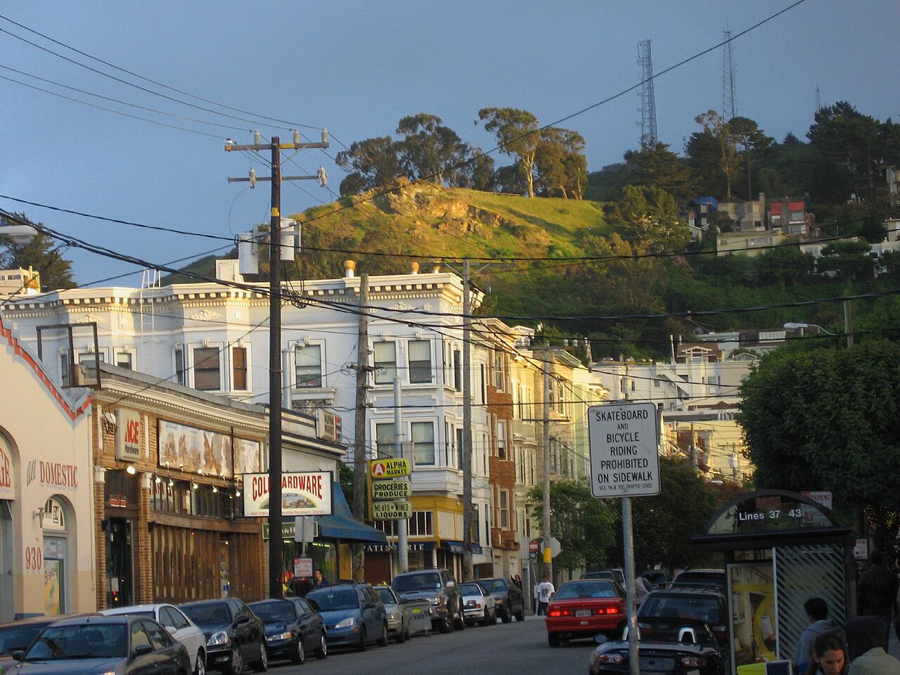
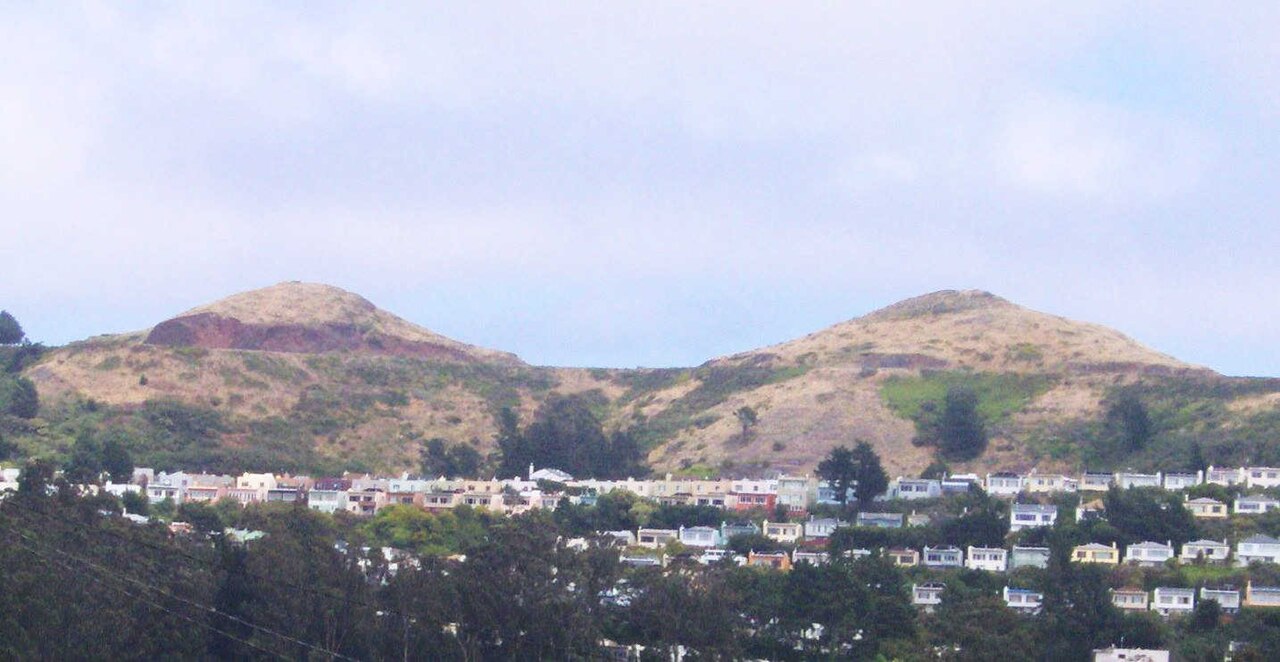
Twin Peaks is a prominent hilltop destination in San Francisco, California, offering sweeping views across the city and surrounding Bay Area. The two distinct summits, known as Eureka Peak and Noe Peak, rise approximately 922 feet above sea level, making them among the highest accessible points in San Francisco. The area functions as a public open space and viewpoint, attracting visitors seeking panoramic vistas. The site holds significance as a natural landmark within an otherwise densely developed urban environment, providing rare unobstructed sightlines across multiple jurisdictions and geographical features.
Checked 2026-08-26
The summit area contains a paved parking lot, viewing platforms, and limited pedestrian pathways. Visitors will find interpretive signage and telescopes for closer observation of distant landmarks. The surrounding terrain features native coastal scrub vegetation, including coyote brush and various wildflowers. No enclosed buildings, visitor centers, or commercial facilities are present at the summit itself. The experience centers entirely on outdoor observation and walking. Restroom facilities are minimal or absent. The landscape remains largely undeveloped, preserving a sense of natural terrain despite its urban location and heavy visitation.
Checked 2026-08-26
Most visitors spend between thirty minutes and one hour at Twin Peaks, sufficient for photography and appreciating the views. Those walking from nearby neighborhoods or combining the visit with surrounding areas may allocate two to three hours. The duration depends heavily on weather conditions, as fog can obscure visibility entirely and prompt early departure. No structured activities or trails extend the visit. Sunset and evening viewing periods naturally lengthen stays. Travelers should build flexibility into schedules, as atmospheric conditions determine the quality of experience more than any on-site features or programs.
Checked 2026-08-26
Twin Peaks operates as an open public space without controlled access. The site remains accessible at all hours, though nighttime visits present safety considerations given isolated conditions and limited lighting. Clear weather yields dramatically superior visibility; morning and late afternoon typically offer the most reliable conditions before marine layer fog advances. Summer afternoons frequently experience complete fog envelopment. Winter storms may create dramatic cloud formations but reduce visibility. Visitors should consult current weather forecasts immediately before traveling, as microclimatic conditions change rapidly and unpredictably at this elevation. Check the operator's own site for the travel date before relying on a schedule or fare.
Checked 2026-08-26
Twin Peaks imposes no admission charge and requires no tickets for access. The public space operates without entry controls or revenue collection infrastructure. Parking at the summit lot is similarly free of charge, though spaces are limited and demand peaks during favorable weather and sunset hours. No commercial concessions operate on-site requiring payment. Visitors incur only transportation costs to reach the location. The absence of formal management presence means no facilities exist for processing any potential future fee structures should policies change. Check the operator's own site for the travel date before relying on a schedule or fare.
Checked 2026-08-26
Private vehicle represents the most common access method, with parking available at the summit lot via Twin Peaks Boulevard. The approach involves winding roads requiring cautious driving. Public transit options include Muni bus routes approaching the base, followed by significant uphill walking. Ride-sharing services operate in the area though pickup and drop-off space is constrained. Cycling presents challenges due to steep gradients. Pedestrian access from surrounding neighborhoods demands physical fitness. Visitors without vehicles should research current transit schedules independently, as service patterns change and no dedicated shuttle serves this destination directly.
Checked 2026-08-26
Weather conditions deteriorate rapidly; fog can eliminate visibility within minutes. Strong winds frequently affect the exposed summit. The area lacks railings at multiple overlook points, creating fall hazards particularly in low visibility. Nighttime visits present isolation risks with minimal lighting and irregular patrol presence. Vehicle break-ins have been reported at the parking area; valuables should not remain visible. The terrain becomes slippery when wet. Wildlife encounters, including coyotes, occur occasionally. Visitors should remain aware of surroundings, avoid distracted walking near edges, and consider traveling in groups during off-peak hours for personal security.
Checked 2026-08-26
Twin Peaks offers exceptional photographic opportunities encompassing downtown San Francisco, the Bay Bridge, Alcatraz, and on clearest days, distant East Bay hills. Sunrise and sunset provide optimal directional lighting for cityscape compositions. Night photography captures illuminated urban infrastructure, though tripod stability challenges exist in wind. Wide-angle lenses accommodate expansive vistas; telephoto lenses isolate architectural details. Fog creates atmospheric, mood-oriented imagery when it partially obscures the city. The best vantage points require short walks from the parking area. Visitors should secure equipment against wind gusts and anticipate rapidly changing conditions that may frustrate planned shots.
Checked 2026-08-26
The summit parking lot provides the most accessible option, with paved surfaces leading to primary viewpoints. However, the most expansive views require navigating uneven terrain and inclines. Full accessibility details are Not recorded pending review.
No organized guided tours operate from this location. Visitors experience the site independently. Commercial tour operators may include brief stops as part of broader San Francisco itineraries, but dedicated Twin Peaks programming is Not recorded pending review.
No designated picnic facilities exist. Visitors may consume food informally, though wind conditions and lack of shelter make this impractical. Formal picnic amenities and policies are Not recorded pending review.
The site remains accessible but presents increased risks including isolation, limited lighting, and reduced emergency response visibility. Visitors should exercise heightened caution and consider personal safety preparations. Official guidance is Not recorded pending review.
The open space character suggests dogs may be present, but specific leash requirements and pet policies are Not recorded pending review. Visitors with animals should observe standard public space etiquette and any posted regulations encountered on-site.
As an uncontrolled open space, formal closure mechanisms are limited. Temporary restrictions for maintenance, fire danger, or severe weather may occur. Current closure protocols and notification methods are Not recorded pending review.
Loading the interactive map…
The interactive map could not be loaded.
Last updated:
Source: OpenStreetMap contributors, Wikidata ·