
1029 min walk
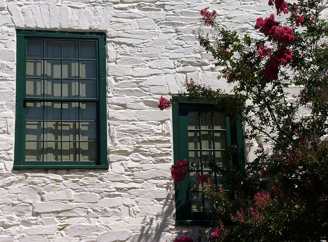
Abner Cloud House
- High · Heritage site
- Historic monument
Historic monument · Washington
| Per person | Free entry |
|---|
Checked 2026-08-31 · Source
Read from the OpenStreetMap access tags; anything not listed has no tag recorded.
Set the group type to family in the planner and the day window contracts to about three quarters of a solo day.
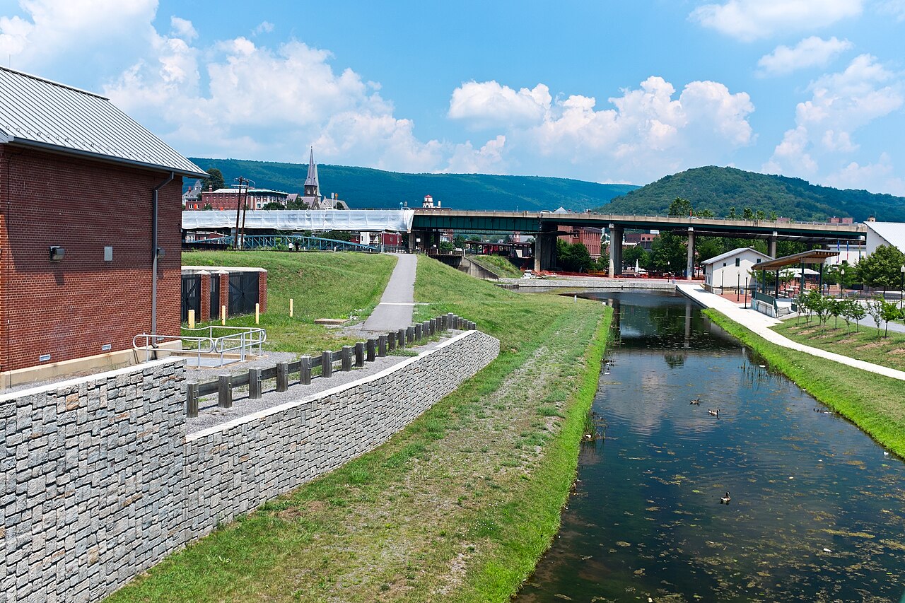
Chesapeake and Ohio Canal National Historical Park preserves a 184.5-mile canal corridor running from Georgetown in Washington, D.C., to Cumberland, Maryland. The canal operated from 1828 to 1924, carrying coal and other goods between the Potomac River and the Ohio River valley before railroads replaced its commercial role. Today, the National Park Service protects the waterway, towpath, locks, lockhouses, aqueducts, and related historic structures. For travellers, the park is both an industrial-history landscape and a long recreation route. Its Washington connection makes Georgetown a convenient urban starting point, while the full corridor reaches through Maryland and West Virginia scenery.
Checked 2026-08-26 · Source
The park contains the historic canal prism, 74 lift locks, 11 aqueducts, 7 guard locks, hundreds of historic structures, and the original towpath, now used by walkers and cyclists. Lockhouses appear along the route, giving the canal a human scale and showing how movement and maintenance once worked. The Great Falls Tavern Visitor Center in Maryland provides exhibits, while the Potomac River gorge, agricultural landscapes, and Allegheny Mountains create changing scenery farther west. Choose a section according to your interests: Georgetown offers an urban edge, Great Falls adds dramatic water scenery, and longer journeys reveal the canal as a continuous historic landscape.
Checked 2026-08-26 · Source
The right length depends on the section chosen. A Georgetown or Great Falls visit can work as an hour-long walk with time for photographs and historic features. A section hike or bike ride needs part of a day, especially when the route includes locks, aqueducts, or a visitor centre. The entire 184.5-mile corridor is a multi-day undertaking for walkers or cyclists and should be planned as a journey rather than a single sightseeing stop. For a Washington, D.C. itinerary, choose one accessible section and reserve enough time to walk at an unhurried pace.
Checked 2026-08-26 · Source
The Chesapeake and Ohio Canal corridor offers a different experience in every season. Spring brings wildflowers and moderate walking temperatures. Summer provides long days and opportunities for outdoor recreation, though heat and humidity can make extended distances demanding. Autumn brings foliage along the wooded towpath, while winter offers quieter conditions and a more exposed landscape. River flooding can affect sections of the trail and may lead to temporary closures, so conditions matter when selecting a route. For a short Washington visit, spring and autumn are especially comfortable for combining Georgetown or Great Falls with a longer outdoor walk.
Checked 2026-08-26 · Source
The park is administered by the National Park Service. A simple walk along the canal corridor is different from activities that may involve permits, reservations, or charges, such as organised groups, commercial use, camping, boating, or special programmes. Plan the visit around the section and activity you want, rather than treating the entire 184.5-mile park as one ticketed enclosure. Georgetown and towpath exploration can be incorporated into a city day, while longer backcountry-style outings require more preparation. Carry the practical supplies needed for your chosen distance, because services are not continuous along the canal.
Checked 2026-08-26 · Source
Choose the access point before setting out. The Georgetown section begins at the Washington, D.C. waterfront, making it the easiest part to pair with an urban itinerary. Great Falls is reached from Maryland Route 189 and provides access to a more dramatic landscape. Farther along the canal, trailheads and parking areas appear at intervals, but rural sections require more deliberate transport planning. Public transport serves some urban approaches; private vehicles are more useful for dispersed rural access. The Capital Crescent Trail connects with the towpath, offering an additional cycling and walking link near Washington.
Checked 2026-08-26 · Source
Towpath conditions range from packed earth to crushed stone, with mud and standing water possible after rain. Potomac flooding can submerge sections, so a route that was suitable previously may be unsafe on another day. The corridor includes wooded and waterside habitats with ticks and mosquitoes. Services become limited between developed access points, so carry water, food, navigation tools, and any medication needed for the planned distance. The canal edge often lacks guardrails, and pedestrians share the narrow towpath with cyclists. Remote areas may have limited mobile coverage. Keep away from the canal prism edge and give other trail users room to pass.
Checked 2026-08-26 · Source
The park offers a rich range of photographic subjects: stone locks, wooden lock gates, calm water reflections, aqueducts, lockhouses, seasonal foliage, and the Potomac gorge near Great Falls. Early morning and late afternoon give the towpath softer light and longer shadows, while changing weather can make the water and masonry more dramatic. Use wide views to show the canal in its landscape and close views to record construction details. Birds and waterfowl add movement without requiring a special viewpoint. Keep equipment away from fragile historic structures, respect adjacent private property, and stay clear of water edges while composing images.
Checked 2026-08-26 · Source
The preserved canal corridor extends 184.5 miles from Georgetown in Washington, D.C., to Cumberland, Maryland.
The park includes the canal prism, 74 lift locks, 11 aqueducts, 7 guard locks, lockhouses, the towpath, and hundreds of historic structures.
The Georgetown section reaches the Potomac River waterfront in Washington, D.C., making it a practical urban starting point.
The original towpath is used for recreation, including walking and cycling, with route conditions varying along the corridor.
The Great Falls section offers Potomac River gorge scenery, and the Great Falls Tavern Visitor Center in Maryland provides exhibits.
Bring water, food, navigation tools, and suitable clothing because services are limited between developed access points along longer sections.
Loading the interactive map…
The interactive map could not be loaded.

Last updated:
Source: OpenStreetMap contributors, Wikidata ·