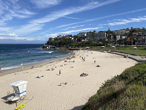
Bronte Beach
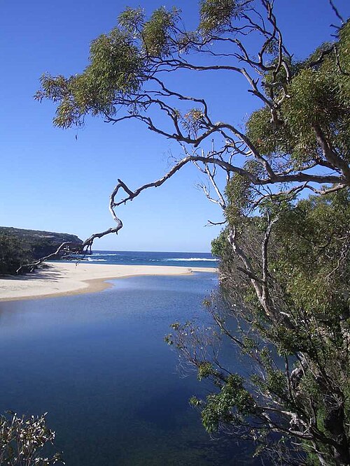
Bronte Beach is a coastal beach within the Sydney metropolitan area, located in the eastern suburbs. It forms part of the sequence of beaches along Sydney's southeastern coastline.
- Must see
- Nature site
City guide · Australia
Sydney is divided by a drowned harbour, steep headlands and long coastal corridors. Circular Quay anchors the Opera House, The Rocks and harbour crossings, whil...
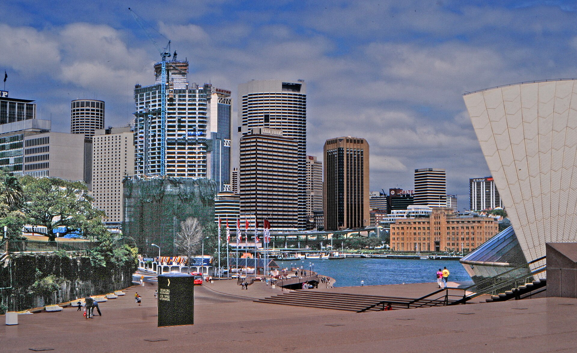
Photograph · W. Bulach · CC BY-SA 4.0
Set your days, your pace and the hours you actually want to be out. The planner works around closing days and travel time, and leaves room to eat.
Editorial responsibility: Elena Voss · Roavina Travel Editor
Sydney is divided by a drowned harbour, steep headlands and long coastal corridors. Circular Quay anchors the Opera House, The Rocks and harbour crossings, while the central business district runs south toward Town Hall and Darling Harbour. Bondi and the eastern beaches occupy a different corridor; Manly begins with a harbour crossing. The city's geography makes transport choices part of the sightseeing plan.
Checked 2026-08-26
November · November in Sydney has mean high 23.8°C, mean low 16.3°C, rainfall 104.0 mm, 12.6 rain days. Mild southern-hemisphere shoulder-season temperatures support long outdoor days. November visitors can plan longer days outside in Sydney with relatively little weather friction.
Ranked by importance — sitelinks, pageviews and heritage status, not editor preference.
53 places match
Category
Typical visit duration
Good for
Interests
Bronte Beach is a coastal beach within the Sydney metropolitan area, located in the eastern suburbs. It forms part of the sequence of beaches along Sydney's southeastern coastline.
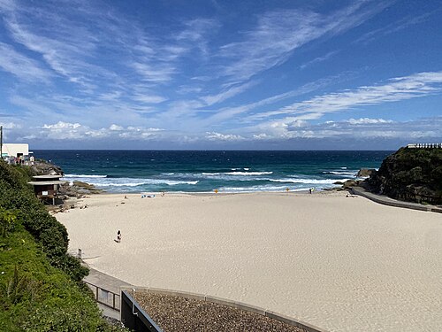
Tamarama Beach is a compact crescent on Sydney’s eastern suburbs coast, positioned between Bondi Beach and Bronte Beach. Steep sandstone headlands press close around the sand, making the Pacific feel immediate and powerful.
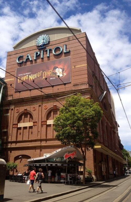
Capitol Theatre is a heritage-listed theatre located in Sydney, Australia. The building occupies a prominent position within the city's entertainment district. Originally constructed in the early twentieth century, the theatre has undergone various transformations throughout its history.
Angel Place Birdcages, also known as Forgotten Songs, is an outdoor artwork in Sydney’s central business district. Suspended cages fill the pedestrian laneway overhead, while recorded birdcalls recall species that once lived around the Tank Stream valley before European settlement.
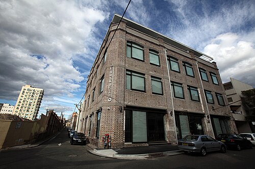
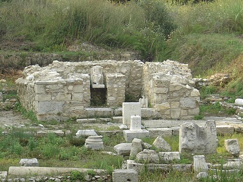
White Rabbit Gallery is a contemporary art museum in Chippendale, Sydney, founded by Judith Neilson to present her collection of twenty-first-century Chinese art. The gallery occupies a converted four-storey knitting factory, giving the visit an industrial architectural setting.
Brett Whiteley Studio is a gallery and studio museum in Sydney dedicated to the life and work of Australian artist Brett Whiteley. The preserved working environment offers a more intimate encounter than a large museum collection.
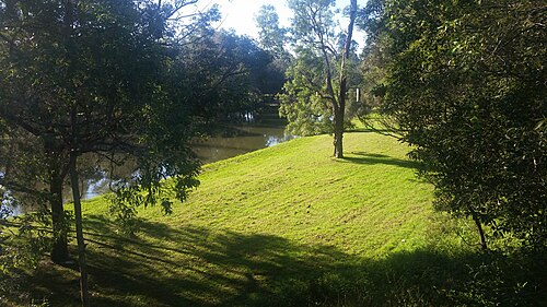
Nielsen Park is a heritage-listed public park situated within Sydney Harbour National Park in the eastern suburbs of Sydney. The park occupies a prominent harbour foreland position in Vaucluse, offering sheltered swimming beaches and picnic grounds.
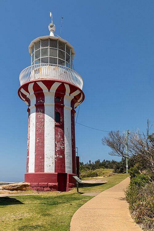
Hornby Lighthouse is a heritage-listed active lighthouse situated at the southern entrance to Sydney Harbour, on the tip of South Head in Watsons Bay.
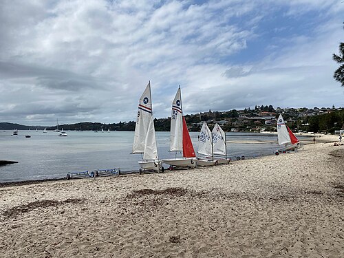
Rose Bay Beach is a harbour beach in Sydney’s eastern suburbs, facing the waters of Port Jackson. It offers a coastal pause within the metropolitan city, with space for swimming, walking, and relaxing beside the harbour.
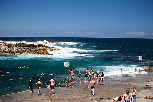
Clovelly Beach is a compact coastal inlet in Sydney’s eastern suburbs. Its narrow, channel-like shape differs from a broad surf beach: concrete platforms and promenades follow rocky edges around the water.
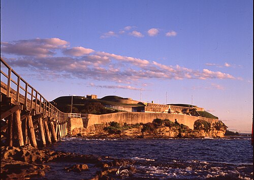
Bare Island Fort is a preserved coastal defence structure on a rocky island in Botany Bay, reached from La Perouse by a narrow causeway. Built in the late nineteenth century, it forms part of Sydney’s military and maritime heritage.
Kamay Botany Bay National Park protects coastal landscapes and culturally significant places around Botany Bay in Sydney. Its two principal visitor areas are Kurnell and La Perouse.
Royal National Park is a large protected landscape on Sydney’s southern edge, stretching between eucalyptus forest, sandstone country, coastal heath and the Pacific shoreline. Established in 1879, it is recognised as one of the world’s oldest national parks.
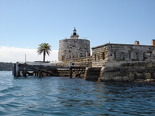
Fort Denison is a heritage-listed former penal site and defensive facility located on a small island in Sydney Harbour, New South Wales.
Shark Island is a small harbour island within Sydney Harbour National Park. Its name refers to historical maritime associations, while the visitor experience centres on vegetation, rocky shoreline, picnic areas and views across the harbour.
North Head Sanctuary is a protected coastal headland area located at the northern entrance to Sydney Harbour. The site forms part of the traditional lands of the Gayamagal people and holds significant Aboriginal cultural heritage.
Freshwater Beach is a sandy coastal cove in Sydney’s Northern Beaches, set between two headlands. Its sheltered shape makes it a natural place for swimming, surfing, sunbathing and a relaxed seaside walk.
Palm Beach is a coastal suburb and beach at the northern end of Sydney's Northern Beaches peninsula. A narrow isthmus places the Pacific Ocean on one side and Pittwater on the other, giving the area two contrasting waterfronts.
Ku-ring-gai Chase National Park is a protected national park located north of Sydney. It encompasses significant natural landscapes including bushland, waterways, and Aboriginal heritage sites.
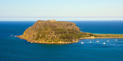
West Head Lookout is a scenic vantage point in Sydney, positioned within Ku-ring-gai Chase National Park on the city's northern peninsula. The lookout offers panoramic views across Broken Bay, Pittwater, and toward the Central Coast.
Parramatta Park is a large public park in Parramatta, western Sydney, beside the Parramatta River. It combines open lawns, mature trees, garden areas, walking paths and colonial heritage associations.
Brickpit Ring Walk
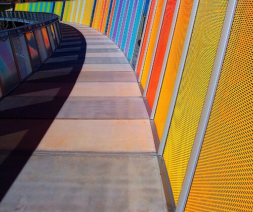
Brickpit Ring Walk is an elevated circular walkway over a former industrial brickpit in Sydney. The route lets visitors look down into the excavated landscape while remaining on a maintained structure above it.
Blaxland Riverside Park is a public park situated along the Parramatta River in Sydney. It forms part of the broader Sydney Olympic Park precinct, developed from the site of the 2000 Olympic Games.
The Garrison Church, also known as Holy Trinity Anglican Church, is a heritage-listed active Anglican church on Argyle Street at the edge of Millers Point in inner Sydney.
Shrine of Saint Anne Catholic Church
St Anne's Church, also known as St Anne's Shrine, is a heritage-listed Roman Catholic church in North Bondi, in Sydney's Waverley Municipality.
Begin at Circular Quay for the Opera House, The Rocks and the harbour edge, then continue south through the city only if the day's museums fit. Darling Harbour forms a western loop from the central grid. Give Bondi and the eastern beaches their own route, and make Manly a ferry-led outing. The Blue Mountains are a regional rail day, not an addition to a central afternoon.
Checked 2026-08-26
Transport for NSW coordinates metro, trains, buses, ferries and light rail, but each mode answers a different piece of Sydney's geography. Ferries serve harbour destinations, rail handles long urban and regional corridors, and light rail or buses connect areas away from heavy rail. Walk within The Rocks, the central grid or one beach district. Check live service information before relying on a harbour or outer-suburban return.
Checked 2026-08-26
Suggested stay for a first visit: 3–5 days. Cover Circular Quay, The Rocks and the central city first, then budget separate time for an eastern-beaches route, Manly or a regional excursion.
Group the Opera House and The Rocks around Circular Quay. Continue through the central grid to Darling Harbour on another loop, and avoid combining Bondi with Manly merely because both are coastal names.
Choose among metro, train, bus, ferry and light rail according to the corridor. Transport for NSW publishes the current journey and disruption information; harbour crossings should be checked like any other scheduled service.
Circular Quay, The Rocks and much of the central grid connect well on foot. Harbour water, steep approaches and the distance to the beaches prevent the wider destination from becoming one continuous walk.
Manly depends on a harbour crossing, the eastern beaches use a different urban corridor, and the Blue Mountains require a regional journey. Check the final workable return for whichever outward trip is chosen.