
7 min walk
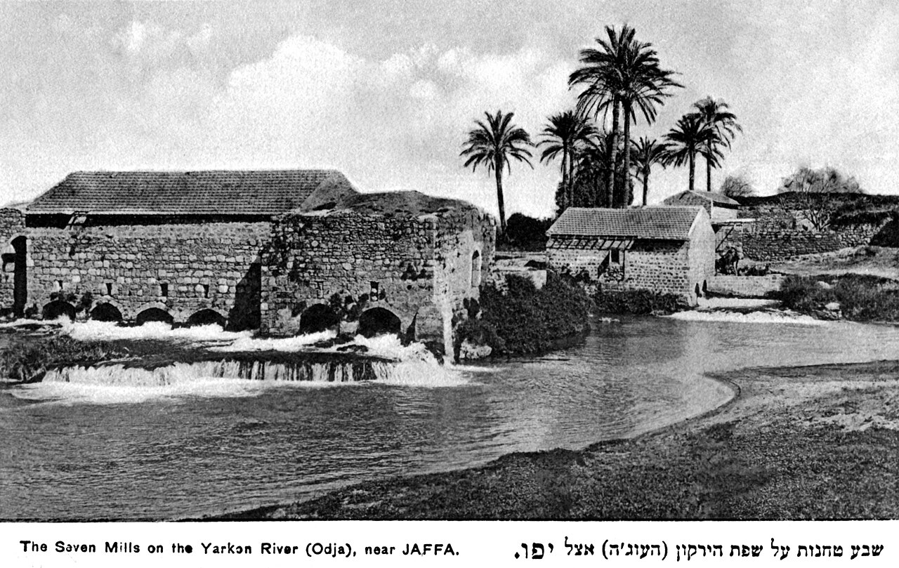
Sheva Tahanot
- Must see
- Historic monument
Language · 11 published
Historic monument · Tel Aviv
גבעת נפוליאון (תל גריסה)
Reviewed by Elena Voss · Roavina Travel Editor
This place is a Attraction.
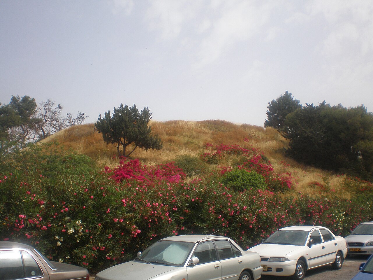
Tel Gerisa, also called Tel Napoleon, is an archaeological mound within Tel Aviv-Yafo. A tel is a settlement hill formed by layers of occupation built up over successive periods, making the landscape itself part of the historical evidence. Tel Gerisa offers a quieter heritage experience than the city’s major attractions. Its value lies in imagining the communities that occupied the coastal plain and reading the mound’s shape, elevation, and visible surface remains within the modern urban setting. Tel Gerisa, locally known as Tel Napoleon, is an archaeological mound situated in the Tel Aviv-Yafo municipality. The site represents an ancient settlement tel, a layered hill formed by successive periods of human occupation. Archaeological investigation has revealed remains spanning multiple historical eras, contributing to understanding of settlement patterns in the coastal plain region. Yes, Tel Napoleon is the local name for Tel Gerisa, referencing an association with Napoleon's campaign in the region.
Checked 2026-08-26 · Source
The mound is the principal feature, with stratified archaeological deposits beneath and around the visible ground surface. Earlier investigations have identified pottery, tools, architectural fragments, and evidence from different occupation phases. This is a place for observing terrain and heritage context rather than visiting display rooms. There are no curated galleries or museum-style exhibits integrated into the mound. Walk slowly, notice changes in elevation, and treat any surface material as part of a protected archaeological landscape rather than as a souvenir or object to handle.
Checked 2026-08-26 · Source
A brief visit focused on the mound and its surroundings can take fifteen to thirty minutes. Visitors with a strong interest in archaeology may spend longer examining the shape of the hill, surface features, and views across the urban landscape. Since the site has no marked interpretive circuit, the experience depends on your own pace and attention. Combine Tel Gerisa with other Tel Aviv-Yafo destinations if you want a fuller outing. Preparation about ancient settlement landscapes can make the quiet site more rewarding.
Checked 2026-08-26 · Source
Visit in the morning during hot months to reduce exposure to the strongest midday sun. The mound is open and provides little shade, so water, a hat, and sun protection are practical companions. Spring and winter conditions can be more comfortable for walking, although rain may make exposed ground slippery. Daylight is important for reading the terrain and spotting surface features. Late-day light can be attractive for photographs, but visibility decreases after sunset because the mound has no documented lighting infrastructure.
Checked 2026-08-26 · Source
Tel Gerisa is an undeveloped archaeological location rather than a ticketed museum, and the mound has no described ticket office or controlled entry system. The visit is therefore suited to a simple outdoor stop without a planned admission purchase. Your main preparation concerns footwear, water, and enough daylight to walk carefully. Treat the location as protected heritage: do not remove pottery or other material, dig, or alter the ground. The mound’s historical value depends on preserving the layers for future study and understanding.
Checked 2026-08-26 · Source
Tel Gerisa sits within Tel Aviv-Yafo’s urban area and can be approached from surrounding city streets. Buses serve the wider district, followed by a walk from the route that best matches your starting point. Standard navigation is useful because the mound can be easy to miss among nearby development. Pedestrian access is the practical way to make the final approach, while dedicated visitor infrastructure is limited. Wear shoes suited to uneven ground and allow time to locate the mound before beginning your walk.
Checked 2026-08-26 · Source
Expect uneven terrain, eroded channels, loose ground, and vegetation that can conceal small holes or changes in level. Rain can make the slopes slippery, while the absence of guardrails and formal paths requires careful foot placement. Keep children close on the mound and avoid climbing unstable edges. Archaeological deposits are protected, so leave pottery, stones, and soil in place. Choose daylight for the visit and carry water in warm weather. The surrounding urban environment also calls for normal awareness near streets and adjacent properties.
Checked 2026-08-26 · Source
Tel Gerisa is best photographed as a landscape: the mound’s profile, its changing elevations, surface textures, and the contrast between ancient terrain and modern Tel Aviv-Yafo. Early morning and late afternoon provide softer light and clearer relief than bright midday conditions. Overcast weather can help reveal details in the ground. Use public access areas and avoid pointing equipment into neighboring private spaces. A compact camera is practical on the uneven surface. Do not move archaeological material to improve a composition or create a staged scene.
Checked 2026-08-26 · Source
Tel Gerisa is also known locally as Tel Napoleon. The alternative name refers to the mound’s association with Napoleon’s campaign in the region.
The main sight is the archaeological mound itself, including its layered terrain, elevation, and visible surface features associated with earlier settlement activity.
A short visit takes about fifteen to thirty minutes. Visitors with a strong archaeological interest can spend longer examining the mound and its surroundings.
No. Tel Gerisa is an outdoor archaeological mound rather than a museum complex, so the visit centers on the terrain and the historical setting.
Bring water, sun protection, and shoes suitable for uneven ground. Daylight is important because the exposed mound has no documented lighting infrastructure.
No. Pottery, stones, soil, and other archaeological material should remain in place. Digging or disturbing the mound damages protected heritage and removes information from its historical layers.
Loading the interactive map…
The interactive map could not be loaded.
Last updated:
Source: OpenStreetMap contributors, Wikidata ·