


6 min walk
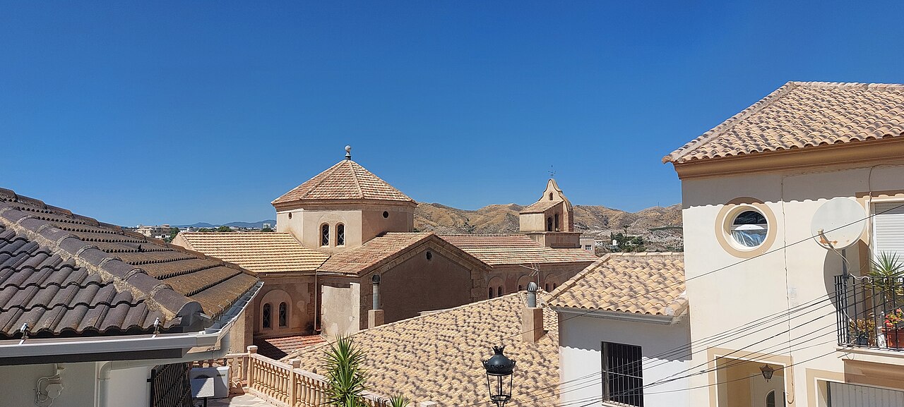
Iglesia de Santiago Apostol
- Must see
- Place of worship

Historic site · Cusco
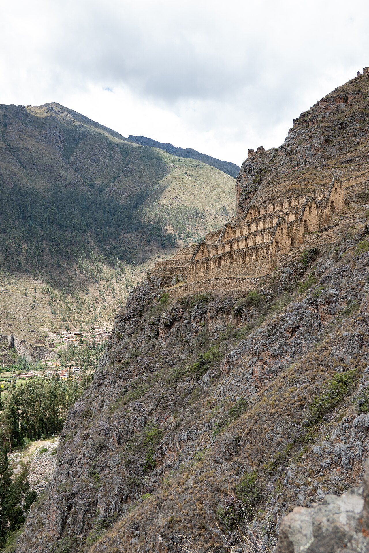
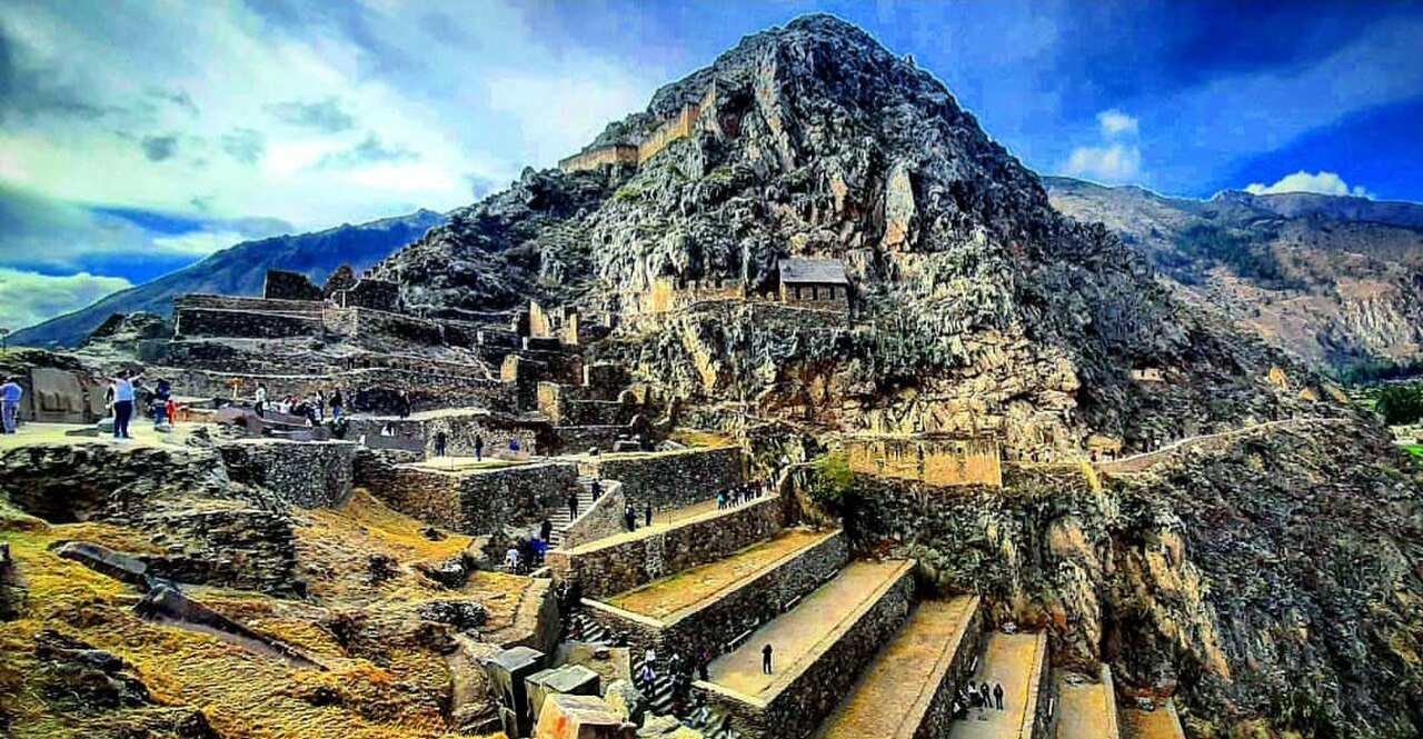
Pinkuylluna is an archaeological hillside on the eastern side of Ollantaytambo. The municipal visitor page places the site at 3,350 metres above sea level and describes it as part of the Campesina community of Ollanta. The hill itself holds rectangular structures, terraces, and funerary evidence. Peru's Mincetur tourism inventory records archaeological evidence spanning several periods, but its altitude field says 2,851 metres. Because that conflicts with the municipality's site-specific figure, this guide uses the municipal altitude and does not attribute 3,350 metres to the inventory.
Checked 2026-10-07 · Source
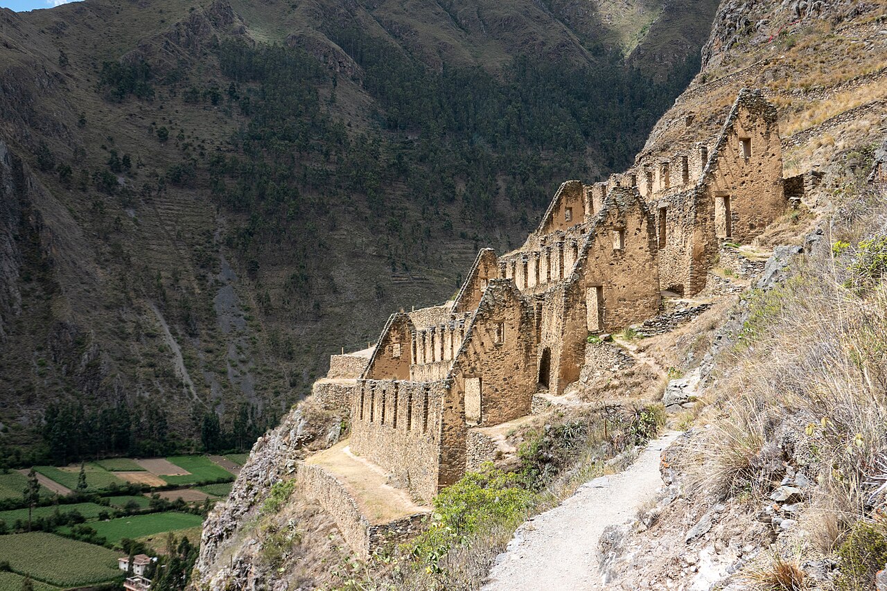
The Mincetur tourism inventory divides Pinkuylluna into two subsectors. Sector A, nearer the settlement, has twelve quadrangular enclosures set on platforms that also serve as retaining walls; the inventory records rough stone, mud mortar, and traces of yellow clay plaster. Sector B has three long, two-level rectangular enclosures, with stairs along their sides and small adjoining terraces. The municipal visitor page describes the hill's rectangular structures as likely colcas, or storehouses, and notes funerary remains, many disturbed. These are archaeological interpretations and recorded features, not a fully restored interior visitors can enter. Observe the masonry and terraces from the established path.
Checked 2026-10-07 · Source
No reviewed official source gives a total visit duration for Pinkuylluna. The Mincetur inventory entry dated 17 October 2024 records an approximately 300-metre, 20-minute walking approach from Ollantaytambo to the site. This is dated route information, not a guarantee of current path conditions or a duration for the climb, time among the structures, or return. Allow time according to your pace, acclimatisation, footing, and the conditions you find, and keep enough daylight for the descent. The path climbs a hillside, so a flat-site estimate would be misleading. Turn back if conditions or your energy make continuing unsafe.
Checked 2026-10-07 · Source
The municipal visitor page does not publish current opening hours or a closure calendar. The Mincetur tourism inventory, last updated on 17 October 2024, records year-round visiting and a time of 07:30–16:30. Treat those as dated inventory fields, not as confirmation of today's operating schedule. Check with the local tourism office or the responsible cultural authority before setting out, and do not begin unless the entrance is open and there is enough daylight for the return. Dry footing is preferable on a steep path, but no season is guaranteed by the reviewed municipal page.
Checked 2026-10-07 · Source
The Mincetur tourism inventory, last updated on 17 October 2024, lists entry as free. The municipal visitor page gives no current price or ticket procedure, and no current confirmation from the site manager was found. Treat the free-entry listing as a dated inventory record rather than a guarantee for your visit. The reviewed sources do not establish that Pinkuylluna is covered by a ticket for Ollantaytambo's main archaeological complex. Confirm access and any charge with the local tourism office or cultural authority before climbing; do not rely on a combined-ticket assumption.
Checked 2026-10-07 · Source
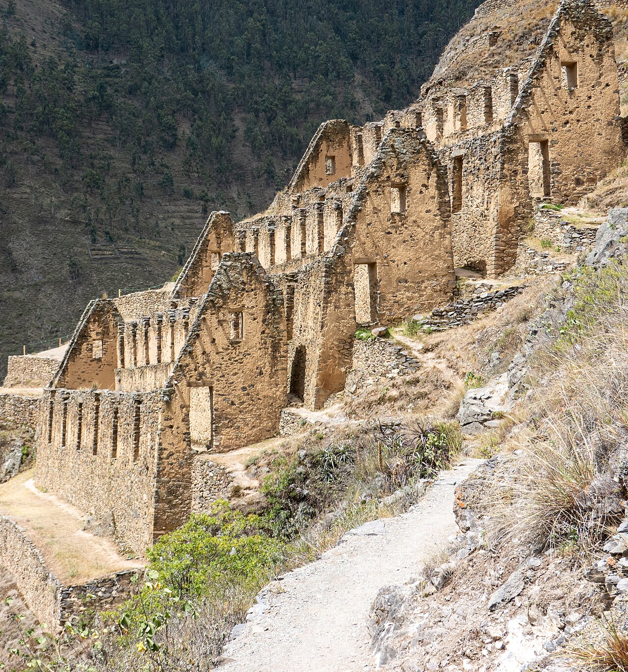
The municipal visitor page says the pedestrian access used by visitors begins at Qosqo Ayllu. Find that entrance in Ollantaytambo rather than trying to approach the structures directly across the slope. The Mincetur tourism inventory, last updated on 17 October 2024, records an approximately 300-metre, 20-minute walk from the town to the archaeological site. This is a dated inventory route record, not a guarantee of today's route conditions. The inventory does not identify a more precise street-by-street route. This is a walk, not vehicle access to the hilltop. Ask locally to confirm the entrance is open, and use the established path rather than residential alleys or an unmarked shortcut.
Checked 2026-10-07 · Source
Pinkuylluna is a hillside walk, not a level archaeological circuit. The Mincetur tourism inventory classifies access as walking or trekking; wear footwear suited to the surface and leave time and energy for the descent. The municipal visitor page notes funerary remains, many of them disturbed, so keep to the path and do not touch or enter archaeological features. The reviewed official pages do not specify guardrails, toilets, drinking water, shade, or step-free access. Carry what you need before starting and check local conditions, especially after rain.
Checked 2026-10-07 · Source
The tourism inventory lists photography and filming, landscape observation, and walking among activities at Pinkuylluna. The elevated view takes in Ollantaytambo, while the enclosures and terraces provide details of the archaeological landscape. Photograph from the path without touching walls or blocking narrow sections. The inventory's activity listing does not grant permission for drones, commercial shoots, tripods, or entry into restricted structures. Ask the responsible cultural authority about any organised or aerial photography, and follow signs or staff instructions on site.
Checked 2026-10-07 · Source
Pinkuylluna is an archaeological hillside above Ollantaytambo, with rectangular structures, terraces, and funerary evidence. The municipality identifies the structures as likely storehouses and records the site at 3,350 metres above sea level.
The municipality's visitor page says the pedestrian access used by visitors begins at Qosqo Ayllu. Confirm that the entrance is open locally before starting the climb.
No reviewed official source gives a total visit duration. The Mincetur inventory entry dated 17 October 2024 records an approximately 300-metre, 20-minute approach from town. This is dated route information, not a guarantee of current path conditions, and it does not include the climb, visit, or descent.
Mincetur's inventory, last updated on 17 October 2024, records year-round visiting from 07:30 to 16:30 and free entry. These are dated inventory entries, not current operator confirmation; the municipality's visitor page does not publish today's hours or fee.
The reviewed official sources do not say that Pinkuylluna is included in the main archaeological complex ticket. Confirm current ticket coverage with the local tourism office or cultural authority before visiting.
The reviewed sources describe a pedestrian hillside approach and trekking, but do not record a step-free route. Expect uneven terrain and confirm current path conditions locally.
Loading the interactive map…
The interactive map could not be loaded.
Last updated:
Source: OpenStreetMap contributors, Wikidata ·