


88 min walk
Wat Nang Liao
- Notable
- Place of worship
Language · 11 published
Nature site · Chiang Mai
Reviewed by Elena Voss · Roavina Travel Editor
| Monday | 08:00 – 17:00 |
|---|---|
| Tuesday | 08:00 – 17:00 |
| Wednesday | 08:00 – 17:00 |
| Thursday | 08:00 – 17:00 |
| Friday | 08:00 – 17:00 |
| Saturday | 08:00 – 17:00 |
| Sunday | 08:00 – 17:00 |
Checked 2026-08-31 · Source
Read from the OpenStreetMap access tags; anything not listed has no tag recorded.
Set the group type to family in the planner and the day window contracts to about three quarters of a solo day.
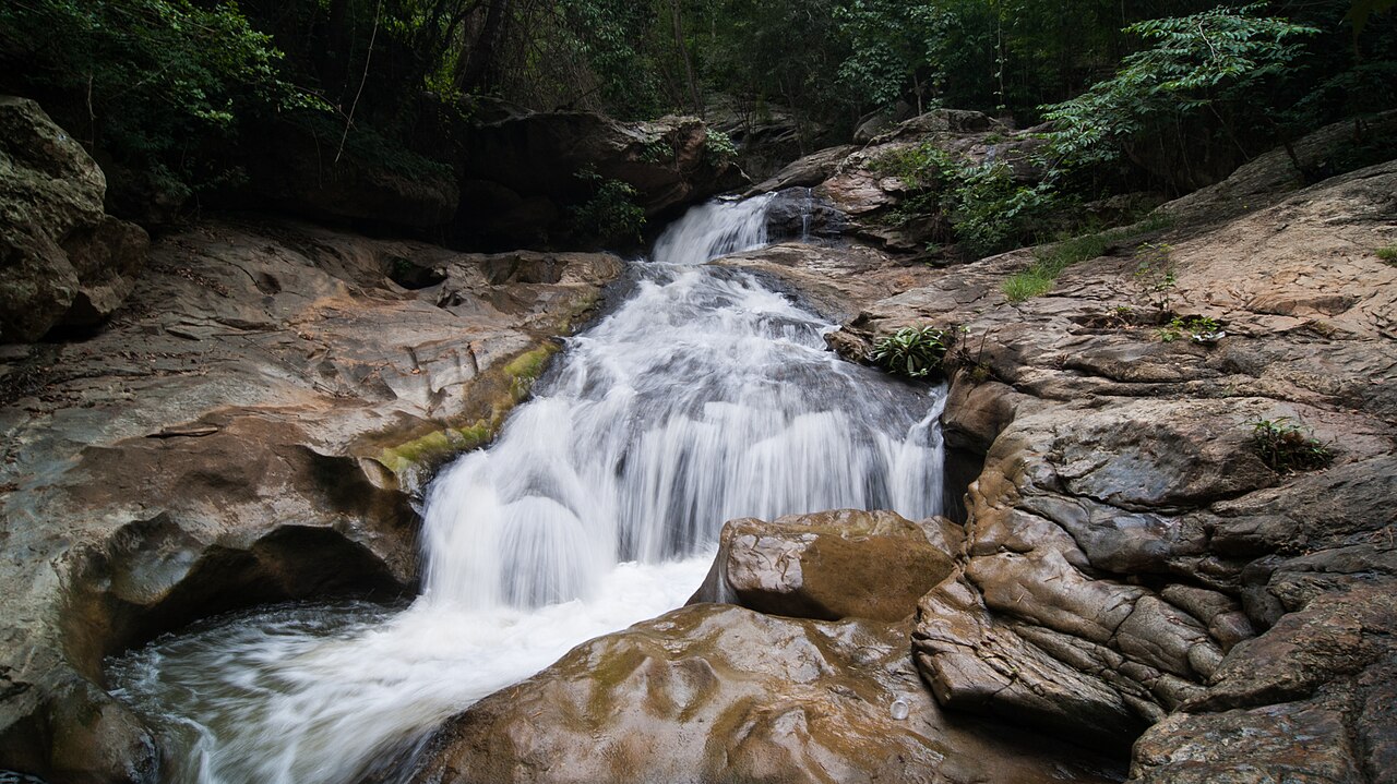
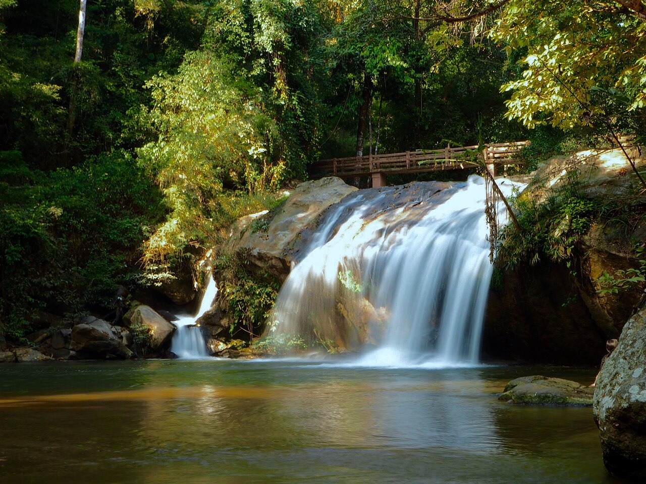
Mae Sa Waterfall is a multi-tiered cascade situated in the Mae Sa Valley area north of Chiang Mai city, within the broader mountainous terrain of northern Thailand. The waterfall lies within Doi Suthep-Pui National Park's jurisdiction, though visitors should verify specific management boundaries. It represents one of several accessible waterfalls in Chiang Mai's hinterland that draw domestic and international visitors seeking natural scenery. The site has established infrastructure including pathways and rest areas developed for tourism purposes over decades. Daily 08:00–17:00.
Checked 2026-08-31 · Source
The waterfall features multiple levels with pools suitable for wading at various tiers. Forest surroundings include tropical vegetation typical of northern Thailand's lower montane ecosystems. Concrete pathways and steps connect the different levels, with railings at steeper sections. Basic facilities including parking areas and food vendors operate near the entrance zone. The water volume fluctuates dramatically between rainy and dry seasons, affecting both visual impact and pool accessibility. Visitors should expect natural conditions rather than manicured parkland throughout the site.
Checked 2026-08-31 · Source
A thorough visit encompassing multiple waterfall tiers requires approximately two to three hours including walking time and brief rests. Photography enthusiasts or those seeking extended time at specific pools may allocate additional duration. The pathway network extends across moderate elevation changes, necessitating pacing for visitors unaccustomed to tropical walking conditions. Combined with travel time from central Chiang Mai, typically forty to sixty minutes each direction depending on transport mode, the excursion consumes half to full day. Doi Suthep–Pui National Park admission: Thai adults 20 THB per person; foreign adults 100 THB per person. Vehicle charges, if applicable, are separate.
Checked 2026-08-31 · Source
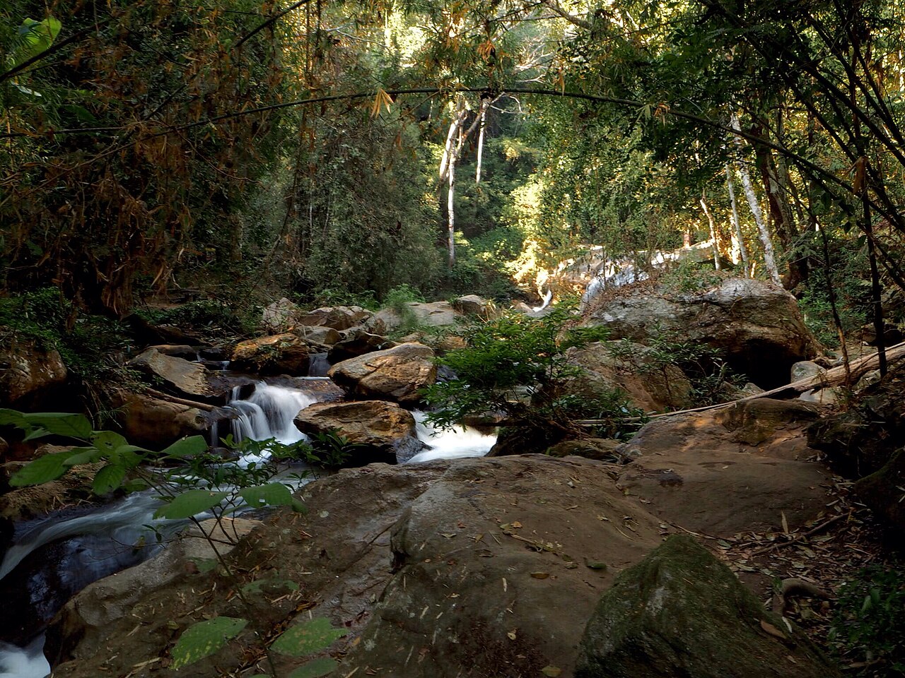
The rainy season from approximately June through October delivers maximum water flow and most dramatic waterfall appearance, though trails become slippery and flash flood risks require attention. Dry season months from November through May offer more predictable access but significantly reduced flow, with some tiers potentially reduced to trickles. Daily 08:00–17:00. Vehicles can reach designated parking areas at waterfall levels 1 and 3. The other waterfall levels are reached on foot; the ten cascades are approximately 100–500 metres apart. An elevated walkway serves the visitor-centre area, while the route through levels 1–10 remains a walking nature trail.
Checked 2026-08-31 · Source
Additional costs may include parking fees, food purchases from vendors, and potential charges for facilities such as restrooms. Visitors should carry sufficient cash, as electronic payment infrastructure may be limited or unavailable at the site. Budget for round-trip transportation separately, whether by hired songthaew, private vehicle, or organized tour arrangement. Doi Suthep–Pui National Park admission: Thai adults 20 THB per person; foreign adults 100 THB per person. Vehicle charges, if applicable, are separate. Vehicles can reach designated parking areas at waterfall levels 1 and 3. The other waterfall levels are reached on foot; the ten cascades are approximately 100–500 metres apart.
Checked 2026-08-31 · Source
Mae Sa Waterfall lies along Route 1096, the Mae Rim-Samoeng road, approximately twenty-five kilometers north of Chiang Mai's old city. Songthaew shared trucks depart from Chang Phuak gate area, though schedules and routes require local confirmation. Private hire through guesthouses or ride applications offers more reliable timing. District-bound public buses depart from Chiang Mai Bus Terminal 1 (Chang Phueak); Mae Rim district also has registered motorcycle-taxi stands for local connections. By road, travel north on the Chiang Mai–Mae Rim road, turn onto the Mae Rim–Samoeng Road (Highway 1096), continue about 9 km and take the signed left turn. The official geological survey places the waterfall about 22.8 km, roughly 26 minutes by car, from central Chiang Mai.
Checked 2026-08-31 · Source
Slippery rocks present persistent hazard, particularly during and following rainfall when algae growth accelerates. Water currents, while generally moderate, can strengthen unexpectedly during storms. Leeches inhabit moist forest areas during rainy season. Sun exposure on open trail sections risks burns without protection. Wildlife encounters including snakes and monkeys require respectful distance. Water quality in pools varies; open wounds warrant caution. Vehicles can reach designated parking areas at waterfall levels 1 and 3. An elevated walkway serves the visitor-centre area, while the route through levels 1–10 remains a walking nature trail.
Checked 2026-08-31 · Source
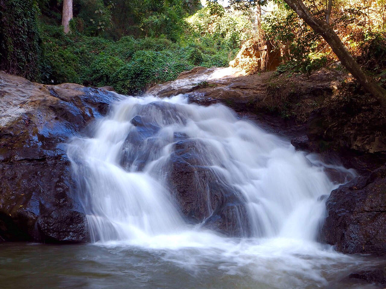
The tiered structure permits varied compositions from wide cascade shots to intimate pool details. Morning light penetrates forest canopy more effectively than midday overhead conditions. Tripod use requires stability on uneven surfaces and awareness of other visitors on narrow pathways. Long exposures for silky water effects demand careful footing. Rainy season delivers dramatic flow but challenges equipment protection. Dry season reveals rock formations obscured at high water. Drone operation falls under national park regulations requiring permit verification. The waterfall has ten cascades descending the hillside, with approximately 100–500 metres between successive levels.
Checked 2026-08-31 · Source
The waterfall has ten cascades descending the hillside, with approximately 100–500 metres between successive levels.
Designated vehicle parking is available at waterfall levels 1 and 3.
Visitors continue on foot from the designated parking areas to reach the other cascades.
The falls cross Triassic granite, approximately 200–250 million years old, parts of which have been metamorphosed into gneiss.
Mae Sa Waterfall is not listed for annual closure in the 2026 schedule; within Doi Suthep–Pui National Park, the scheduled 1 May–30 September closure applies to the Doi Pui summit campground.
A flash flood struck Mae Sa Waterfall at 16:20 on 15 August 2026; one visitor sustained minor injuries and everyone was brought to safety. The DNP directs staff to restrict or close risky waterfall areas during dangerous conditions.
Loading the interactive map…
The interactive map could not be loaded.

Last updated:
Source: OpenStreetMap contributors, Wikidata ·