
2 min walk · Beyoğlu
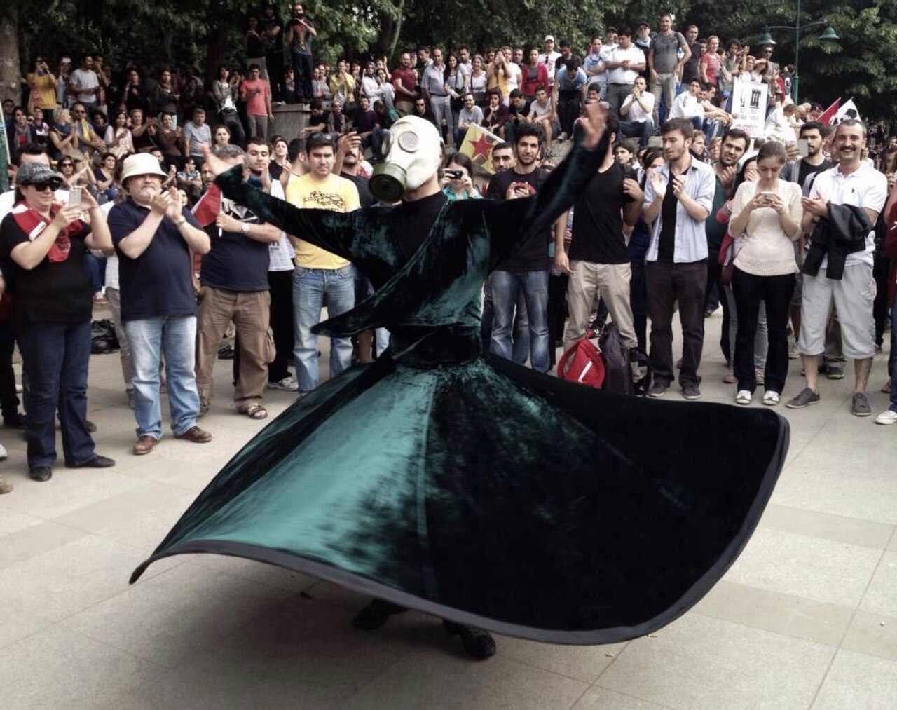
Gezi Park protests
- High
- Historic monument
Language · 11 published
Historic monument · Beyoğlu, Istanbul
Taksim Meydanı
Reviewed by Elena Voss · Roavina Travel Editor
| Monday | 00:00 – 23:59 |
|---|---|
| Tuesday | 00:00 – 23:59 |
| Wednesday | 00:00 – 23:59 |
| Thursday | 00:00 – 23:59 |
| Friday | 00:00 – 23:59 |
| Saturday | 00:00 – 23:59 |
| Sunday | 00:00 – 23:59 |
Checked 2026-08-31 · Source
Read from the OpenStreetMap access tags; anything not listed has no tag recorded.
Set the group type to family in the planner and the day window contracts to about three quarters of a solo day.
This place is a Attraction.
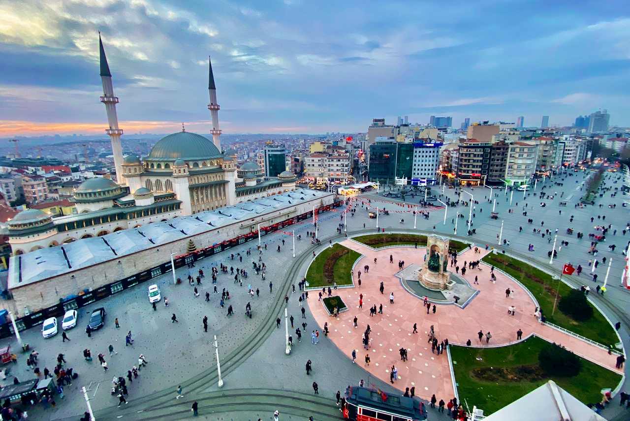
Taksim Square is where modern Istanbul argues with itself. It is the head of İstiklal Avenue, the terminus of the metro, the hub of the municipal buses, and the place the country's politics spills into when it spills anywhere. The name is prosaic. Taksim means division or distribution in Arabic, and this was the point under Mahmud I where the main water lines from the north of the city were collected and branched off to the rest of it. No regular closure applies; it is a 24-hour public space. The central square is broad and level, with lifts connecting the accessible M2 station and F1 funicular. Tactile paving, curb ramps and nearby accessible public transport support a step-free visit. Taksim Square: The public square is accessible 24 hours daily. Demonstrations, official ceremonies, construction and police security zones can temporarily close parts of the square or adjoining streets. Access to the square and Republic Monument is free. Nearby museums, performances and the nostalgic tram use separate tickets or fares. The central square is broad and level, with lifts connecting the accessible M2 station and F1 funicular. Tactile paving, curb ramps and nearby accessible public transport support a step-free visit. M2 metro and F1 funicular terminate beneath Taksim; F1 connects directly with Kabataş and T1. Numerous IETT buses use stops around Cumhuriyet Caddesi and Tarlabaşı Boulevard.
Checked 2026-08-31 · Source
A square, a monument, and two buildings that face each other across an argument. The Atatürk Cultural Centre stands on the eastern side and reopened after renovation in 2021. The Taksim Mosque, which opened the same year, faces it from the western flank. The two buildings, new at the same moment on opposite sides of the same square, are as clear a statement of modern Turkish politics as anything in the city. Gezi Park is on the northern edge. Yes. The square and Republic Monument require no ticket. M2 metro and F1 funicular terminate beneath Taksim; F1 connects directly with Kabataş and T1. Numerous IETT buses use stops around Cumhuriyet Caddesi and Tarlabaşı Boulevard.
Checked 2026-08-31 · Source
Fifteen minutes for the square; an afternoon for İstiklal and Beyoğlu beyond it. The square itself is a transport interchange with a monument in the middle, and it does not reward standing about. What it is good for is starting from. İstiklal down to the Tünel is a twenty-minute walk without stopping and two hours with. Galata Tower is ten minutes beyond the Tünel, downhill. Yes. Level paving and station lifts provide step-free access.
Checked 2026-08-31 · Source
The public square is accessible 24 hours daily. Demonstrations, official ceremonies, construction and police security zones can temporarily close parts of the square or adjoining streets. Prayer, maritime weather, conservation, security and dated events can replace ordinary access. The F1 funicular runs between Taksim and Kabataş.
Checked 2026-08-31 · Source
Access to the square and Republic Monument is free. Nearby museums, performances and the nostalgic tram use separate tickets or fares. The base amount and currency follow the official operator tariff. Transport, inner sections, evening programmes and separately operated venues remain excluded unless named. Its western entrance starts at the southwest side of Taksim Square.
Checked 2026-08-31 · Source
M2 metro and F1 funicular terminate beneath Taksim; F1 connects directly with Kabataş and T1. Numerous IETT buses use stops around Cumhuriyet Caddesi and Tarlabaşı Boulevard. Use the named gate, pier or stop because the historic peninsula, hills and controlled compounds can separate entrances and exits. Yes. Ceremonies, demonstrations and security operations can create temporary cordons.
Checked 2026-08-31 · Source
The central square is broad and level, with lifts connecting the accessible M2 station and F1 funicular. Tactile paving, curb ramps and nearby accessible public transport support a step-free visit. No regular closure applies; it is a 24-hour public space. Yes. The square and Republic Monument require no ticket. Yes. Level paving and station lifts provide step-free access. Worship, shoe removal, crowds and historic surfaces remain relevant. The public square is accessible 24 hours daily. Demonstrations, official ceremonies, construction and police security zones can temporarily close parts of the square or adjoining streets.
Checked 2026-08-31 · Source
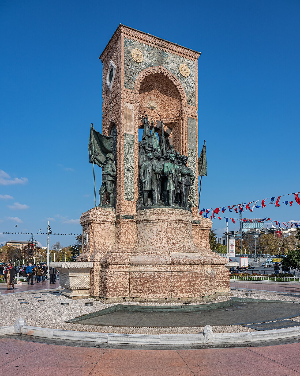
The Monument of the Republic is the square's only real subject, and Canonica's 1928 groups read best from close in at an upward angle rather than from across the traffic. İstiklal at night with the nostalgic tram coming through the crowd is the photograph most people take away from Beyoğlu, and it needs a fast lens rather than a flash. Photographing police or gendarmerie deployments is unwise anywhere in Turkey and specifically unwise here. The square is modern, wide and hard-surfaced; it gives a camera much less than the streets leading off it. Access to the square and Republic Monument is free. Nearby museums, performances and the nostalgic tram use separate tickets or fares.
Checked 2026-08-31 · Source
No regular closure applies; it is a 24-hour public space.
Yes. The square and Republic Monument require no ticket.
Yes. Level paving and station lifts provide step-free access.
The F1 funicular runs between Taksim and Kabataş.
Its western entrance starts at the southwest side of Taksim Square.
Yes. Ceremonies, demonstrations and security operations can create temporary cordons.
Loading the interactive map…
The interactive map could not be loaded.

Last updated:
Source: OpenStreetMap contributors, Wikidata ·