


12 min walk
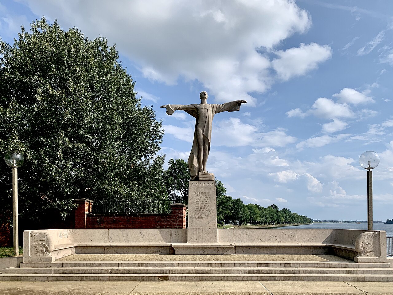
Titanic Memorial
- Notable · Heritage site
- Historic monument

Nature site · Washington
| Monday | 05:00 – 01:00 |
|---|---|
| Tuesday | 05:00 – 01:00 |
| Wednesday | 05:00 – 01:00 |
| Thursday | 05:00 – 01:00 |
| Friday | 05:00 – 01:00 |
| Saturday | 05:00 – 01:00 |
| Sunday | 05:00 – 01:00 |
Checked 2026-08-31 · Source
| Per person | Free entry |
|---|
Checked 2026-08-31 · Source
Read from the OpenStreetMap access tags; anything not listed has no tag recorded.
Set the group type to family in the planner and the day window contracts to about three quarters of a solo day.
East Potomac Park is a peninsula park in Washington, D.C., extending into the Potomac River south of the Tidal Basin and the National Mall. Water surrounds several sides of the park, giving the landscape a distinctly open waterfront character. It is a quieter recreational setting than the monument core, with broad green areas, paths, and room to pause beside the river. The peninsula layout makes the park useful for a walk, a cycle ride, or a relaxed outdoor stop during a day focused on central Washington.
Checked 2026-08-26 · Source
The park combines waterfront paths, lawns, trees, and recreational facilities. Walkers and cyclists can follow routes beside the Potomac and view the water from several sides of the peninsula. Golf facilities occupy part of the park, creating a different rhythm from the open paths and river scenery. The Titanic Memorial is one of the principal points of interest: its granite sculpture shows a man with outstretched arms and commemorates the men who died in the 1912 sinking. The park is primarily an outdoor landscape, so the experience comes from movement, views, greenery, and the memorial rather than indoor exhibits.
Checked 2026-08-26 · Source
Allow about one hour for a focused visit to the waterfront paths and Titanic Memorial. That length gives enough time to walk at an easy pace, look closely at the sculpture, and pause for river views. A longer visit suits travelers who want to cycle around more of the peninsula, sit on the lawns, or use the golf facilities. Because the park supports several kinds of outdoor activity, the right duration depends on whether it is a short scenic break or a substantial recreational stop. It also works well as breathing space between busier National Mall sights.
Checked 2026-08-26 · Source

Daylight is the most useful time for visiting East Potomac Park because the paths, river views, lawns, and memorial are outdoor features. Spring and autumn are comfortable seasons for walking and cycling in Washington. Summer can bring heat and humidity across the exposed peninsula, so an early or later part of the day is more comfortable for active visits. Winter offers a different, quieter atmosphere but colder conditions beside the water. Plan the stop around the activity you want: the memorial suits a short daytime visit, while walking and cycling benefit from comfortable weather.
Checked 2026-08-26 · Source
The waterfront paths, lawns, and Titanic Memorial form the public outdoor part of East Potomac Park. A traveler visiting those features can treat the stop as a free outdoor sightseeing visit. Golf is a separate activity within the park and involves its own course-use costs. Other spending can come from transport, food, equipment, or parking connected with the wider outing rather than from viewing the memorial itself. If a visit is planned around golf, separate that purpose from a simple walk so the time and spending expectations remain clear.
Checked 2026-08-26 · Source
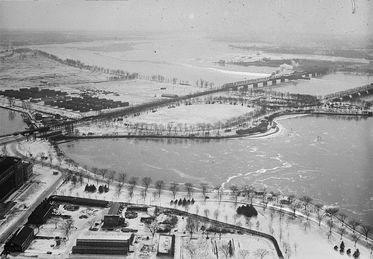
East Potomac Park sits in the southwestern part of central Washington, south of the Tidal Basin and National Mall. Reaching it from the main monument area involves following the routes that lead onto the peninsula and then continuing through the park. Walking is practical for travelers already near the Tidal Basin, while cycling suits the park's waterfront paths and connections from downtown. Metrobus serves the general area, with a walk from the relevant stop. Driving is possible, but the peninsula setting makes parking planning important, especially during busy sightseeing periods.
Checked 2026-08-26 · Source
Much of East Potomac Park is exposed to sun, wind, heat, and rain, with limited shelter along the open waterfront. Children need close supervision near the river edge. Walkers and cyclists share parts of the path network, so keep to the appropriate side and leave room when passing. Golf areas bring the additional hazard of balls and course activity; respect their boundaries. Bring water and sun protection for warm-weather visits. After dark, quieter sections and reduced visibility make a daytime visit more comfortable for most sightseeing itineraries.
Checked 2026-08-26 · Source

The Titanic Memorial is the park's clearest close-up subject, with its granite figure and symbolic pose providing strong detail and form. Waterfront paths offer photographs of the Potomac, open sky, and distant Washington views. The peninsula's shape creates long lines beside the water, while sunrise and sunset can add directional light to the river landscape. Photograph golf areas from appropriate public positions and avoid interfering with play. The park's open setting suits handheld landscape photography. Drone use is subject to the strict airspace rules that apply across Washington, D.C.
Checked 2026-08-26 · Source
You can walk or cycle beside the Potomac, enjoy open green areas, see the Titanic Memorial, and find golf facilities within the park.
Allow about one hour for the waterfront paths and Titanic Memorial. Cycling or golf makes the visit substantially longer.
No. The Titanic Memorial is an outdoor granite sculpture within East Potomac Park.
Yes. Waterfront paths make cycling one of the main ways to explore the peninsula and its river views.
Yes. Golf facilities are located within the park and form a separate recreational activity from walking to the memorial.
It is on a peninsula in the Potomac River, south of the Tidal Basin and the National Mall in Washington, D.C.
Loading the interactive map…
The interactive map could not be loaded.
Last updated:
Source: OpenStreetMap contributors, Wikidata ·