
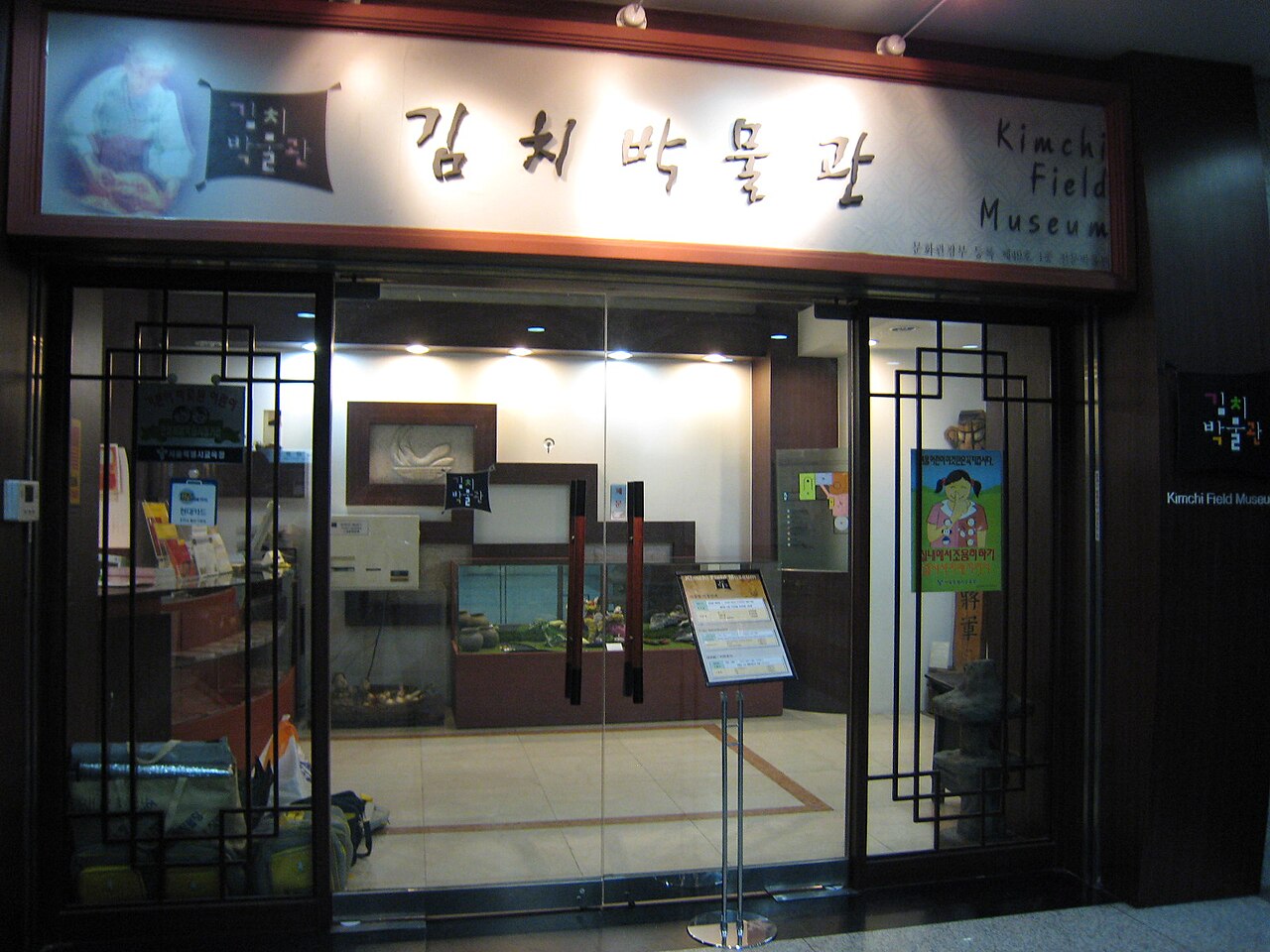
1 min walk
Museum Kimchikan
- Must see
- Museum
Historic monument · Seoul
서울한양도성
| Monday | 00:00 – 23:59 |
|---|---|
| Tuesday | 00:00 – 23:59 |
| Wednesday | 00:00 – 23:59 |
| Thursday | 00:00 – 23:59 |
| Friday | 00:00 – 23:59 |
| Saturday | 00:00 – 23:59 |
| Sunday | 00:00 – 23:59 |
Checked 2026-08-31 · Source
| Per person | Free entry |
|---|
Checked 2026-08-31 · Source
Read from the OpenStreetMap access tags; anything not listed has no tag recorded.
Set the group type to family in the planner and the day window contracts to about three quarters of a solo day.
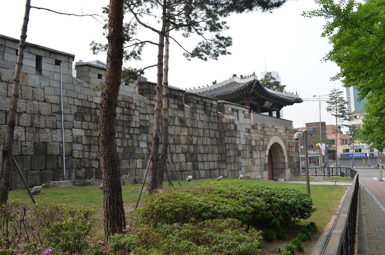
The Seoul City Wall, known locally as 서울한양도성, is a historic fortification that originally enclosed the capital of the Joseon dynasty. The wall was constructed to protect Hanyang, as Seoul was then called, and defined the boundaries of the city for centuries. Portions of the original structure remain standing today, offering visitors a tangible connection to Korea's pre-modern urban planning and defensive architecture. The wall represents one of the most significant historical landmarks in contemporary Seoul. city_place_id; stored names and coordinates were copied without approximation.
Checked 2026-08-31 · Source
The surviving sections of the Seoul City Wall include various gates, watchtowers, and stretches of stone and earthen ramparts. Notable preserved gates include Sungnyemun and Heunginjimun. The wall traverses diverse terrain including four of Seoul's mountains: Bugaksan, Inwangsan, Naksan, and Namsan. Walking trails follow much of the remaining structure. The exact condition and accessibility of individual segments varies. Some portions have been restored while others retain more authentic aged characteristics. Museums and informational markers appear at certain locations.
Checked 2026-08-31 · Source
The original Seoul City Wall measured approximately 18. 6 kilometers in total length, encircling the entirety of historic Hanyang. A complete circuit on foot would require considerable time and physical stamina due to the mountainous terrain. Most visitors experience selected segments rather than attempting the full course. The duration of any visit depends entirely on which sections are chosen and individual walking pace. Bugaksan and Inwangsan sections involve steep climbs. Flatter portions near certain gates permit quicker passage.
Checked 2026-08-31 · Source
Baegak, Naksan, Namsan and Inwangsan trails: open 24 hours daily. Sungnyemun Gate: March–May and September–October 09:00–18:00; June–August 09:00–18:30; November–February 09:00–17:30. The outdoor trails have no weekly closure day. Sungnyemun Gate is closed every Monday; its restricted hours apply to the gate, not the surrounding trail. The Seoul City Wall can be visited year-round, though weather conditions significantly affect the experience especially on mountain sections. Spring and autumn generally offer moderate temperatures and clearer visibility. Summer brings heat and humidity that make climbing strenuous. Winter snow and ice create hazardous conditions on stone pathways and steep trails. Early morning and late afternoon provide favorable lighting for observation.
Checked 2026-08-31 · Source
Free admission (KRW 0) for the Seoul City Wall trails. Seoul’s official visitor information also explicitly lists the Naksan section and the publicly accessible city gates as free. Certain associated museums or specific gate structures may have separate admission policies. Visitors should carry sufficient cash as some facilities in the vicinity may not accept card payments. Special guided programs if available would require separate verification of costs and reservation procedures.
Checked 2026-08-31 · Source
The wall has multiple entry points. For Baegak, take Subway Line 3 to Gyeongbokgung Station Exit 3, then bus 7212, 1020 or 7022 to Jahamungogae Ridge and walk about 2 minutes to Changuimun. For Naksan and Heunginjimun, use Dongdaemun Station on Lines 1 or 4, Exit 6 or 7; the gate is about 1 minute away. For Namsan, use Dongguk University Station on Line 3, Exit 5; Jangchung Gymnasium is about 2 minutes away. For Inwangsan, use Seodaemun Station on Line 5, Exit 4; the Site of Donuimun is about 2 minutes away. For Sungnyemun, use Seoul Station Exit 4 on Lines 1 or 4, the Airport Railroad or the Gyeongui–Jungang Line; walk about 5 minutes. This is the named approach for an independent visit. Multiple subway stations provide access to different segments of the Seoul City Wall. Dongdaemun History and Culture Park station serves the eastern sections near Heunginjimun. Changuimun and Hyehwa stations access northern portions. City Hall and Seoul Station lie near western and southern gates respectively. Bus routes connect to various trailheads.
Checked 2026-08-31 · Source
There is no continuous step-free circuit: the wall follows four mountain ridges, and both the Baegak and Inwangsan trails are rated difficulty 5 out of 5. The Inwangsan trail contains rocky sections; Baegak rises to 342 metres and involves a demanding mountain route. Naksan is the gentlest mountain section, rated difficulty 2 out of 5. Jongno village bus 03 reaches the Naksan Park terminus, avoiding the longer uphill approach from a subway station. Naksan Park has one designated accessible parking space. The separate Seoul City Wall Museum beside Heunginjimun lists accessible pathways, elevators, accessible toilets and accessible parking. The access description applies to the documented visitor route. Mountain sections of the wall present genuine physical challenges including steep ascents, uneven stone surfaces, and exposed heights. Proper footwear is essential. Weather changes rapidly on elevated terrain. Bugaksan requires identification for military zone access and has controlled entry points. Some sections close temporarily for conservation work or safety concerns without advance public notice. Wildlife including snakes may be encountered in vegetated areas.
Checked 2026-08-31 · Source
The Seoul City Wall offers diverse photographic subjects including historic stonework, cityscape vistas, mountain scenery, and traditional gate architecture. Early morning and golden hour provide optimal natural lighting particularly for east-facing and west-facing sections respectively. Tripods may attract scrutiny in sensitive areas near military zones. Weather haze commonly reduces visibility for distant city views. Night photography is possible near illuminated gates though trail sections lack lighting and become hazardous after dark. Respect signage restricting camera use at specific points.
Checked 2026-08-31 · Source
The wall is 18.6 kilometres long and generally stands 5–8 metres high.
The responsible public body says a one-day circuit is possible but recommends dividing it into six trail sections.
The Changuimun–Hyehwamun section is 4.7 kilometres, takes about 3 hours and is rated difficulty 5 out of 5.
The Naksan Mountain Trail is rated difficulty 2 out of 5; its official route is 3.2 kilometres and takes about 1 hour.
The Jangchung Gymnasium–Baekbeom Square section is 6.7 kilometres, takes about 3 hours and is rated difficulty 3 out of 5.
The Site of Donuimun–Changuimun section is 4 kilometres, takes about 2 hours 30 minutes and is rated difficulty 5 out of 5; the official guidance warns of rocky sections, especially in winter.
Loading the interactive map…
The interactive map could not be loaded.
Last updated:
Source: OpenStreetMap contributors, Wikidata ·