El Retiro Park
Parque del Retiro
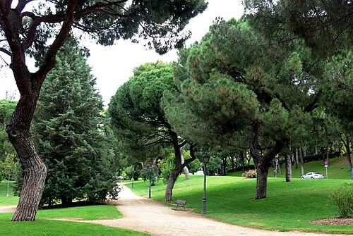
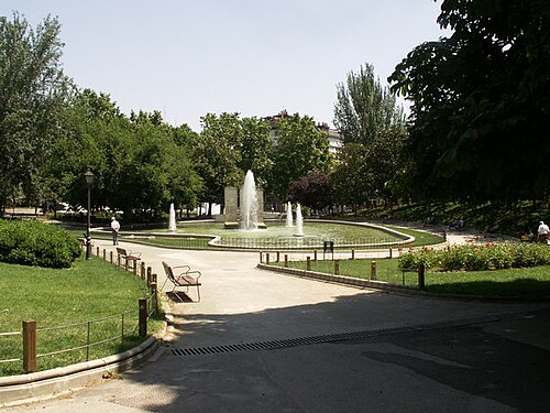
El Retiro is the historic municipal garden that fills the ground east of the Paseo del Prado, and it is the only part of central Madrid large enough to lose an afternoon in.
- Must see
- Nature site
Language · 11 published
City guide · Spain
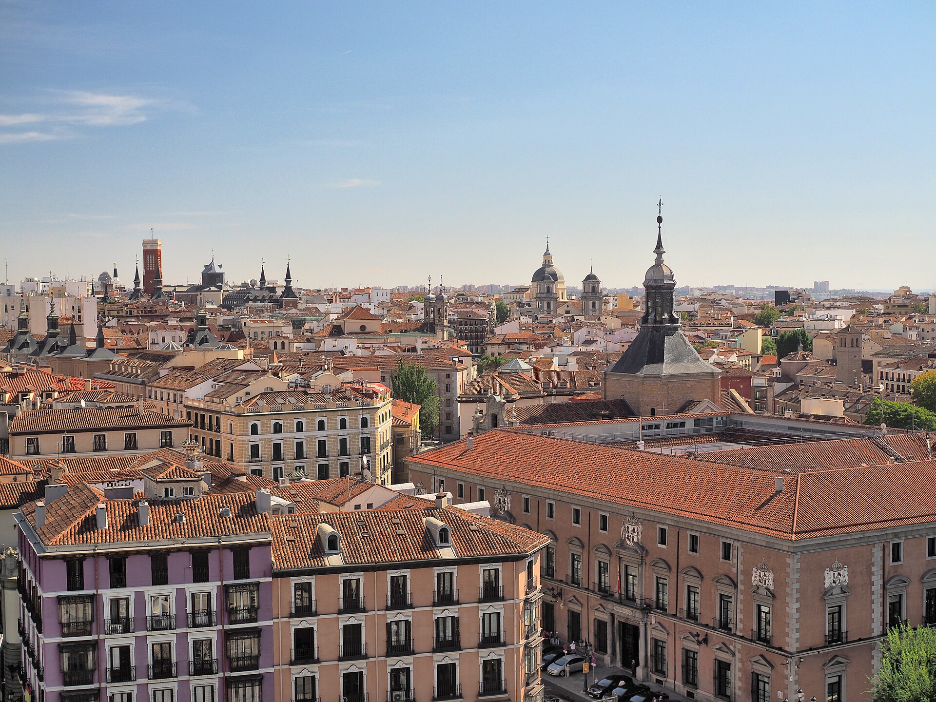
Madrid is Spain's capital, set on the central plateau and organised around a dense historic and cultural core rather than a major riverfront. The oldest royal quarter, known as Madrid de los Austrias, runs between the Royal Palace and Plaza Mayor. East of Puerta del Sol, Gran Vía, the Literary Quarter and the Paseo del Arte carry the principal commercial streets and art museums. Neighbourhoods such as La Latina, Lavapiés, Malasaña, Chueca, Chamberí and Salamanca then form distinct dining, nightlife and residential clusters around that centre.
Reviewed by Elena Voss · Roavina Travel Editor
Set your days, your pace and the hours you actually want to be out. The planner works around closing days and travel time, and leaves room to eat.
Ranked by importance — sitelinks, pageviews and heritage status, not editor preference.
13 places match
Category
Typical visit duration
Interests
Parque del Retiro
El Retiro is the historic municipal garden that fills the ground east of the Paseo del Prado, and it is the only part of central Madrid large enough to lose an afternoon in.
Real Jardín Botánico de Madrid
The Real Jardín Botánico is a working research institute of the CSIC, Spain's national research council, that happens to be open to the public.
Plaza de España is a prominent public square in central Madrid, Spain. The open space features a large monument dedicated to Miguel de Cervantes, the celebrated Spanish writer.
Jardines de Sabatini
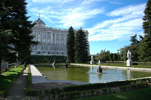
Sabatini Gardens, or Jardines de Sabatini, is a formal green space beside Madrid’s Royal Palace. Its geometric layout, clipped hedges, fountains, statues, and palace setting make it a compact sightseeing stop in the city centre.
Jardines del Campo del Moro
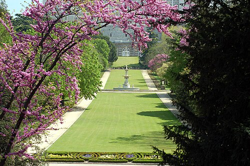
Campo del Moro is a historic garden complex located in Madrid, Spain, situated at the western foot of the Royal Palace. Its local name, Jardines del Campo del Moro, reflects its long-standing identity within the city.
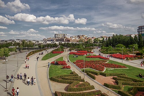
Madrid Río is a long urban park and green corridor beside the Manzanares River in Madrid. It occupies the riverbanks reshaped after the M-30 ring road was placed underground, creating a broad public landscape for walking, cycling, recreation, and rest.
Parque del Oeste is one of Madrid’s major western green spaces, offering a broad change of pace from the city’s museums, avenues, and busy central squares.
Real Observatorio de Madrid
The Royal Observatory of Madrid, or Real Observatorio de Madrid, is an astronomical observatory with an important place in Spain’s scientific history. Founded by King Charles III, it reflects the Enlightenment interest in observation, measurement, and organized scientific work.
Plaza de Oriente is a historic square in central Madrid, located between the Royal Palace and the Teatro Real opera house. Its formal gardens and geometric layout create a distinguished public space in the Spanish capital.
Plaza de la Paja is a historic square in Madrid's La Latina neighbourhood, within the city's oldest medieval district. Its name derives from the Spanish word for straw, referencing its past association with hay and fodder markets.
Parque Juan Carlos I
Parque Juan Carlos I is a major public park in Madrid, Spain. Named after King Juan Carlos I, it forms part of the city's northeastern green corridor near Barajas Airport.
Parque de Berlín
Berlin Park, or Parque de Berlín, is a public green space in Madrid named for the German capital. It forms part of the city’s network of neighbourhood parks, giving residents an open place for strolling and everyday outdoor time.
Jardines de Cecilio Rodríguez is a landscaped garden in Madrid named after Cecilio Rodríguez, a notable figure in Spanish garden design. It offers an urban green setting for walking, quiet observation and time away from the city’s busier streets.
Source: OpenStreetMap contributors, Wikidata ·
Puerta del Sol is the practical centre for orientation. Westward lie Plaza Mayor, the Austrias quarter and the Royal Palace; eastward, Gran Vía leads toward Cibeles while the Paseo del Arte runs south past the major museums and Retiro. La Latina and Lavapiés sit south of the old core, with Malasaña and Chueca to the north. Salamanca lies east of Retiro, and the Castellana axis continues north toward the business district and the Bernabéu. Casa de Campo and Madrid Río are separate green corridors west of the centre.
Checked 2026-08-26
Walk between the Austrias quarter, Sol, Gran Vía and the Paseo del Arte, then use public transport for longer links. Madrid's official tourism service lists metro, city buses and Cercanías suburban trains among the ways to move around the capital. Cercanías also connects Madrid with towns in the region, including El Escorial and Aranjuez. Consult the current official maps and service information before travel because routes, works and ticket conditions can change.
Checked 2026-08-26
A fixed stay length is not recorded. Plan the Austrias and Sol core, the Paseo del Arte and Retiro, then add neighbourhood time or a regional excursion according to your priorities.
Use Puerta del Sol as the central reference. Plaza Mayor, the Austrias quarter and the Royal Palace extend west, while Gran Vía and the museum axis extend east.
Walk within the central neighbourhoods and use the metro for longer connections. The official network reaches the major museums, shopping streets, traditional quarters and northern visitor areas.
They cluster along the Paseo del Arte east of the historic core and close to Retiro. Treat this as one walking district rather than crossing the city between individual museum visits.
No. It lies north along the Castellana axis in a separate modern district. Metro is the practical connection from Sol, Gran Vía or the museum area.