
14 min walk
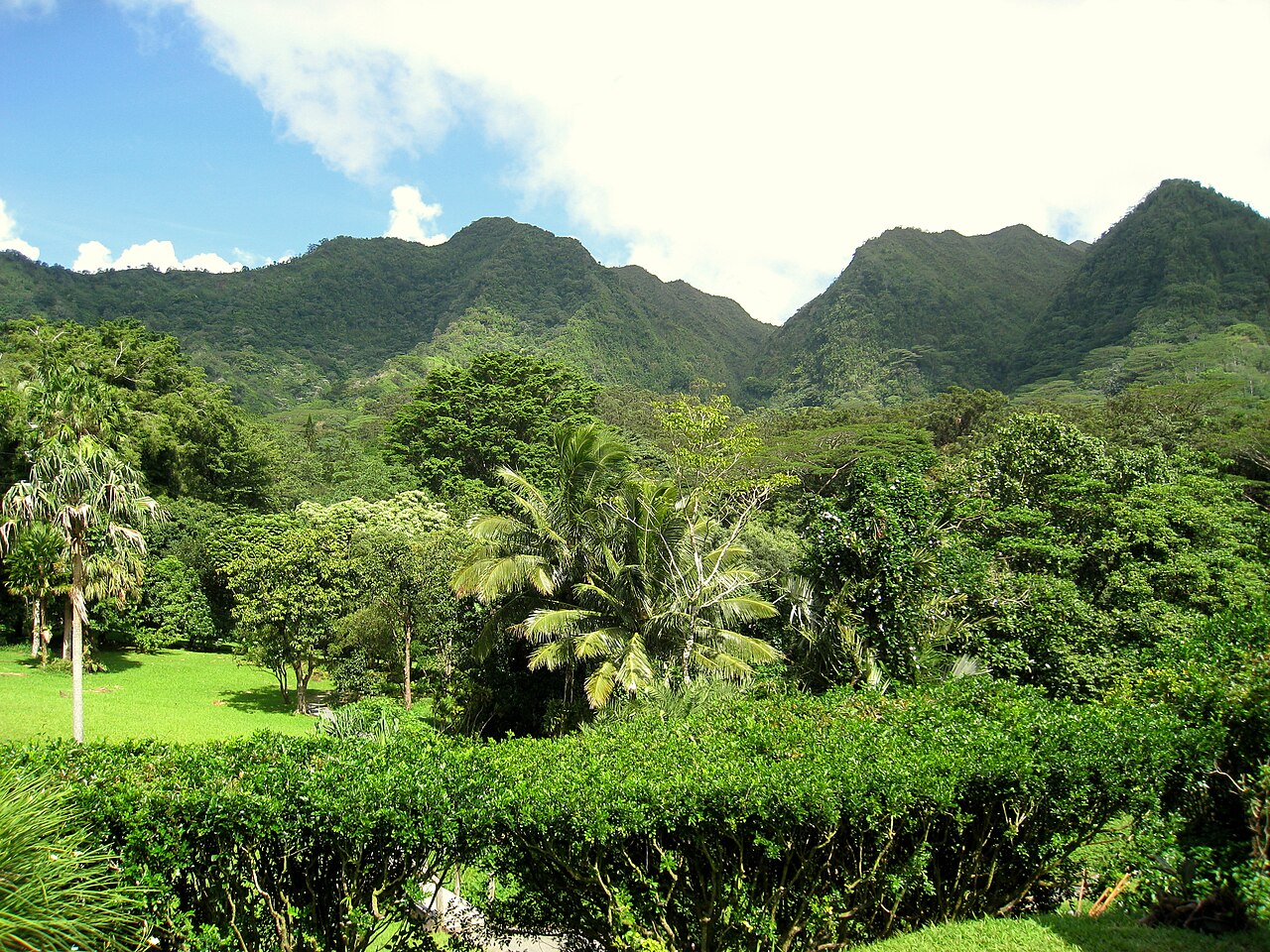
Lyon Arboretum
- Must see
- Nature site
Language · 11 published
Viewpoint · Honolulu
Reviewed by Elena Voss · Roavina Travel Editor
Read from the OpenStreetMap access tags; anything not listed has no tag recorded.
Set the group type to family in the planner and the day window contracts to about three quarters of a solo day.
This place is a Viewpoint.
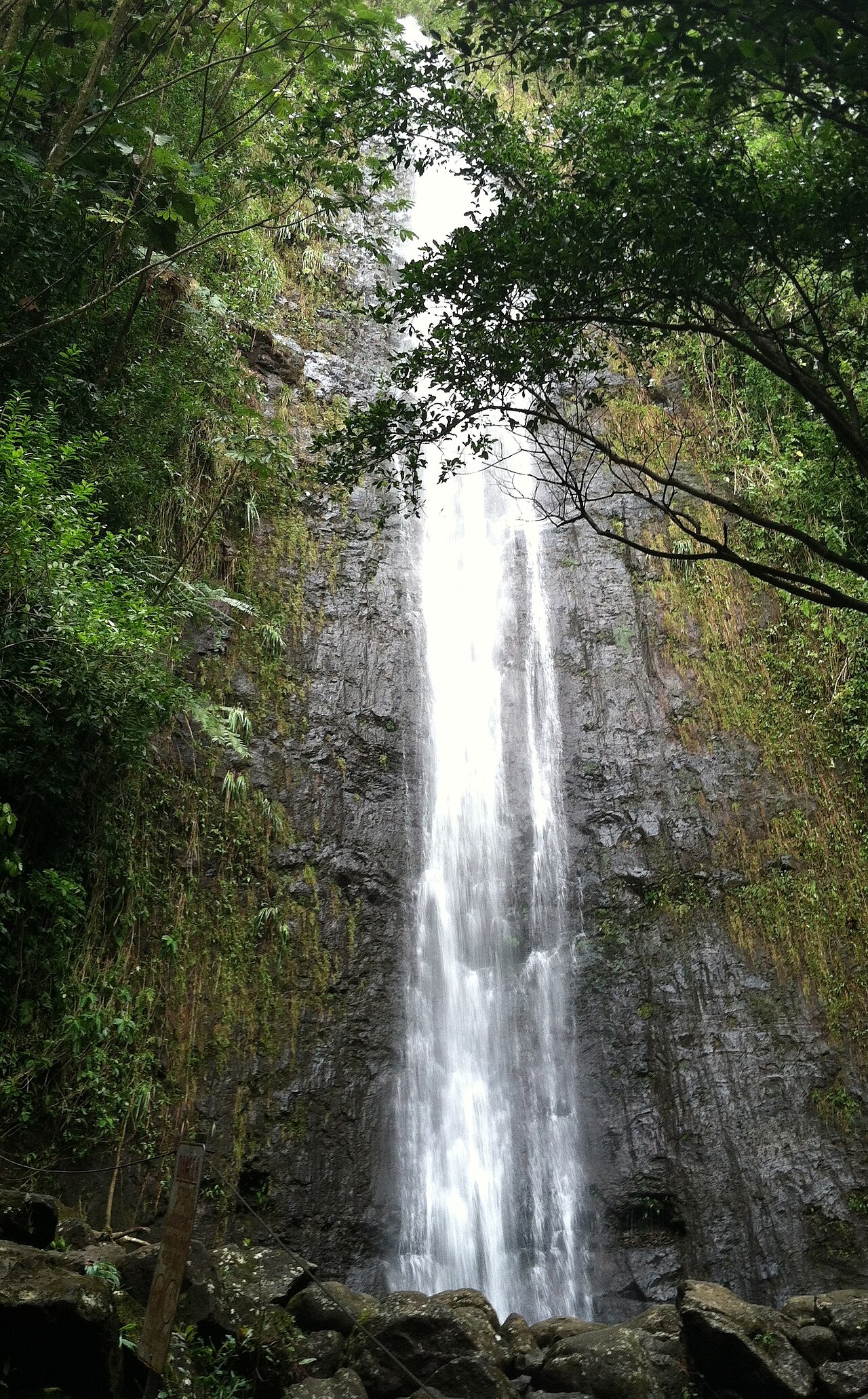
Mānoa Falls is a rainforest waterfall reached by a popular valley trail above Honolulu. This fast draft is tied to the exact OSM identity already ranked in the Honolulu editorial bundle, so it must not be transferred to a nearby namesake or broader district. The visit matters for the transition from the Mānoa Valley forest to the waterfall, with the trail forming most of the experience. Daily: sunrise to sunset. No regular weekly closure day. DLNR’s temporary 2026 maintenance restrictions ended by April 11, when regular hours resumed. Free public admission to the trail. Privately operated parking is separate from trail admission.
Checked 2026-08-31 · Source
The experience at Mānoa Falls centres on a humid forest route, dense vegetation, muddy or uneven trail surfaces, streamside scenery, and a waterfall viewpoint. Start with the transition from the Mānoa Valley forest to the waterfall, with the trail forming most of the experience, then add secondary elements only when access and conditions allow. No regular weekly closure day. DLNR’s temporary 2026 maintenance restrictions ended by April 11, when regular hours resumed.
Checked 2026-08-31 · Source
No operator-stated visit duration is recorded for Mānoa Falls. Build the stop around one complete primary experience rather than an invented fixed schedule: the transition from the Mānoa Valley forest to the waterfall, with the trail forming most of the experience. Add margin for orientation, queues, walking, controlled access, weather, rest, and the transition to the next Honolulu stop. Free public admission to the trail. Privately operated parking is separate from trail admission. The complete route is not step-free: DLNR documents new steps on the resurfaced trail. The route includes a footbridge and a small-stream crossing, with uneven, muddy and slippery conditions possible.
Checked 2026-08-31 · Source
Choose the visit according to the site itself: exposed outdoor places depend on light, heat, rain, and ocean or trail conditions, while museums and memorials depend on current access arrangements. Confirm the operator’s latest notice before departure. Daily: sunrise to sunset. Take TheBus Route 5 MANOA VALLEY to its Manoa Rd/Kumuone terminus, stop 3266. Continue along Manoa Road into Paradise Park, proceed up the fire lane past the Lyon Arboretum entrance, and use the trailhead kiosk straight ahead. The fire lane and Lyon Arboretum are not trail parking areas. The complete route is not step-free: DLNR documents new steps on the resurfaced trail.
Checked 2026-08-31 · Source
Do not infer free entry from public ownership, an outdoor setting, or the absence of a price field, and do not infer a charge from a controlled entrance. Check the linked operator or institutional source for admission, reservations, eligibility, cancellations, and separately priced experiences. Free public admission to the trail. Privately operated parking is separate from trail admission. The complete route is not step-free: DLNR documents new steps on the resurfaced trail. The route includes a footbridge and a small-stream crossing, with uneven, muddy and slippery conditions possible. Rest areas with benches and interpretive signs are provided along the trail.
Checked 2026-08-31 · Source
For Mānoa Falls, travel to the signed trail approach in Mānoa Valley and confirm the current public access point rather than relying on the waterfall coordinate. Check the final entrance, access path, stop, or check-in point before leaving. Take TheBus Route 5 MANOA VALLEY to its Manoa Rd/Kumuone terminus, stop 3266. Continue along Manoa Road into Paradise Park, proceed up the fire lane past the Lyon Arboretum entrance, and use the trailhead kiosk straight ahead. The fire lane and Lyon Arboretum are not trail parking areas. The route includes a footbridge and a small-stream crossing, with uneven, muddy and slippery conditions possible.
Checked 2026-08-31 · Source
At Mānoa Falls, plan for mud, slippery roots, heavy-rain risk, mosquitoes, falling debris, closed sections, and barriers around the pool. Follow barriers, posted notices, staff or ranger directions, and local conduct expectations. The complete route is not step-free: DLNR documents new steps on the resurfaced trail. Rest areas with benches and interpretive signs are provided along the trail. The official DLNR map gives the trail length as 0.8 miles (1.3 kilometres) each way. DLNR describes it as a good trail for novice hikers, although wet conditions can make the surface slippery.
Checked 2026-08-31 · Source
The strongest photographic subjects at Mānoa Falls include forest canopy, wet vegetation, trail textures, and the waterfall from the designated viewing area. Work only from lawful visitor areas and keep paths, doorways, viewpoints, exhibits, and memorial spaces clear. Check posted rules and staff guidance. The official DLNR map gives the trail length as 0.8 miles (1.3 kilometres) each way. DLNR describes it as a good trail for novice hikers, although wet conditions can make the surface slippery.
Checked 2026-08-31 · Source
The official DLNR map gives the trail length as 0.8 miles (1.3 kilometres) each way.
DLNR describes it as a good trail for novice hikers, although wet conditions can make the surface slippery.
The trail crosses a footbridge and then a small stream before continuing through a grove of Eucalyptus robusta.
No. The waterfall and pool are closed because of rockfall risk; visitors must remain behind the cable or marked safe-viewing boundary.
Mānoa Valley receives about 160–170 inches of rain annually, and DLNR identifies mud, slippery surfaces and uneven footing as recurring conditions.
Yes. DLNR installed rest areas with benches and interpretive signs during the trail’s major refurbishment.
Loading the interactive map…
The interactive map could not be loaded.
Last updated:
Source: OpenStreetMap contributors, Wikidata ·