
15 min walk
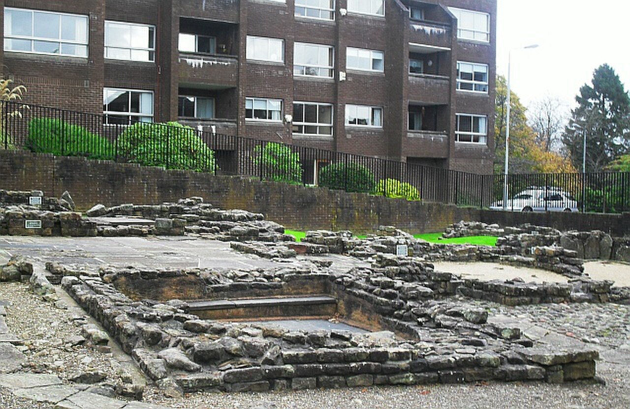
Bearsden Roman Bath House
- Must see · Heritage site
- Historic monument
Historic monument · Glasgow
The Antonine Wall is a Roman frontier monument crossing Scotland’s Central Belt between the Firth of Forth and the Firth of Clyde. Built during the reign of Emperor Antoninus Pius around AD 142, it marked the empire’s northern frontier. Near Glasgow, the remains are best understood as a scattered archaeological landscape rather than a continuous masonry wall. Bearsden, Croy Hill and Bar Hill each reveal a different part of its story. The Antonine Wall is a Roman frontier fortification stretching across Scotland's Central Belt. Constructed around 142 AD under Emperor Antoninus Pius, it represents the northwesternmost boundary of the Roman Empire. The wall extended approximately 39 miles between the Firth of Forth and the Firth of Clyde. Today, visible remains exist at multiple points near Glasgow, including sections at Bearsden, Croy Hill, and Bar Hill. The site holds UNESCO World Heritage status as part of the Frontiers of the Roman Empire serial inscription, shared with Hadrian's Wall and others. No. The Antonine Wall was primarily a turf rampart on a stone base, and little above-ground structure survives. Visible remains are mostly ditches and mound traces.
Checked 2026-08-26 · Source
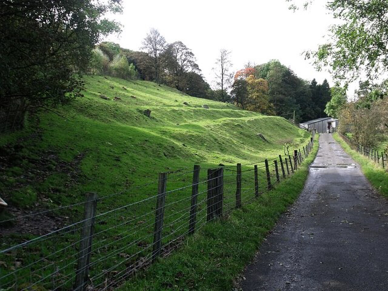
At different points, visitors see ditches, rampart lines, fort platforms and low earthworks. Bearsden is associated with visible bathhouse foundations, while Croy Hill and Bar Hill present elevated traces of Roman military occupation and broad views across the surrounding landscape. The Hunterian Museum in Glasgow and the National Museum of Scotland in Edinburgh hold related artefacts. Bring patience: the most important features are often changes in ground level rather than tall standing ruins. Visitors encounter varying remains depending on location. Some sites display foundation ditches and rampart mounds. At Bearsden, bathhouse foundations are visible. Croy Hill offers earthwork traces with interpretive signage. Bar Hill features fort platform remnants and panoramic views. Museum collections of associated artifacts reside at the Hunterian Museum in Glasgow and the National Museum of Scotland in Edinburgh.
Checked 2026-08-26 · Source
Allow around one hour for a focused visit to a single accessible section such as Bearsden or Croy Hill. This gives you time to walk around the remains, read interpretation and look across the terrain that shaped the frontier. Visiting several locations takes much longer because the wall is dispersed. A full-day plan works best for travellers combining multiple sites with a museum visit or other attractions around Glasgow.
Checked 2026-08-26 · Source
The wall is an outdoor archaeological landscape, so daylight and ground conditions strongly influence the experience. Longer summer days make it easier to combine distant sections, while winter weather can leave paths muddy and make low earthworks harder to distinguish. Spring and autumn can provide attractive light and quieter walks. Choose a day when you are comfortable spending time outdoors, with clothing and footwear suited to Glasgow’s changeable weather.
Checked 2026-08-26 · Source
The archaeological remains are generally encountered as open-air monuments without an admission gate, particularly at rural earthwork locations. The Hunterian’s Roman material forms part of a separate museum visit, and the National Museum of Scotland is another place to see associated objects. Your main costs for exploring the wall are therefore transport between dispersed locations and any museums or refreshments included in your day.
Checked 2026-08-26 · Source
Bearsden, Croy and Bar Hill are among the more accessible points for visitors based in Glasgow. Rail travel can serve Bearsden and Croy, although the final approach to the remains involves walking. A car gives greater freedom to link several sites, while cycling suits travellers interested in covering longer stretches. The wall continues beyond the city toward Falkirk and Bo’ness, so plan each stop as a separate destination rather than expecting one central entrance.
Checked 2026-08-26 · Source
The wall’s traces can be easy to miss, and uneven ground is common at rural locations. Stay on established paths where they exist and avoid climbing archaeological features. Long grass may conceal muddy patches or ticks, especially in warmer months. Facilities are limited at many points, so carry water and plan breaks around settlements or museums. Some sections cross land with access arrangements that differ from one location to another.
Checked 2026-08-26 · Source
Photographs work best when they show how the frontier fits into the wider landscape. Low morning or late-afternoon light can cast shadows across shallow ditches and ramparts, making their outlines easier to read. Croy Hill and Bar Hill provide useful elevated viewpoints for landscape compositions. Since little masonry survives above ground, combine wide views with details of the terrain and interpretation rather than expecting a towering wall.
Checked 2026-08-26 · Source
No. It was primarily a turf rampart built on a stone base, and the surviving evidence is mostly ditches, mounds and archaeological foundations.
No continuous modern trail follows the whole route. Visitors usually explore selected sections such as Bearsden, Croy Hill and Bar Hill as separate walks.
Bearsden has visible bathhouse foundations, while Croy Hill and Bar Hill show earthwork traces and Roman fort-related remains.
Around one hour is suitable for walking around a single section, reading interpretation and taking in the surrounding landscape.
Older children who enjoy history and outdoor walks can appreciate the site, although the remains are subtle and there are no playground facilities at the archaeological locations.
The Hunterian Museum in Glasgow and the National Museum of Scotland in Edinburgh hold artefacts associated with the Antonine Wall and Roman Scotland.
Loading the interactive map…
The interactive map could not be loaded.
Last updated:
Source: OpenStreetMap contributors, Wikidata ·