Cairo Citadel
قلعة صلاح الدين
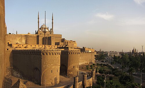
The Cairo Citadel, known locally as Qal'at Salah al-Din al-Ayyubi, is a medieval fortress complex occupying a strategic hilltop in eastern Cairo.
- Must see
- Historic monument
City guide · Egypt
Cairo is a vast Nile metropolis whose visitor geography includes Downtown, Historic Cairo, Coptic Cairo, Zamalek and the Giza plateau. Downtown holds modern civ...
Photograph · Faris El-Gwely · CC BY 4.0
Set your days, your pace and the hours you actually want to be out. The planner works around closing days and travel time, and leaves room to eat.
Reviewed by Elena Voss · Roavina Travel Editor
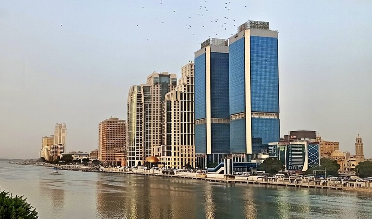
Cairo is a vast Nile metropolis whose visitor geography includes Downtown, Historic Cairo, Coptic Cairo, Zamalek and the Giza plateau. Downtown holds modern civic and cultural landmarks; medieval Islamic streets extend east and south; Coptic sites cluster around Old Cairo; and Giza lies across the river but forms part of the standard Greater Cairo visit. Give each area its own block and expect slow cross-city journeys.
Checked 2026-08-26
September · September still averages 33.1°C by day in Cairo, making heat a substantial planning constraint even as summer eases.
Ranked by importance — sitelinks, pageviews and heritage status, not editor preference.
24 places match
Category
Typical visit duration
Interests
قلعة صلاح الدين
The Cairo Citadel, known locally as Qal'at Salah al-Din al-Ayyubi, is a medieval fortress complex occupying a strategic hilltop in eastern Cairo.
Historic Cairo is a UNESCO World Heritage site encompassing one of the world's oldest Islamic cities, founded in the tenth century. It became the new centre of the Islamic world, reaching its golden age in the fourteenth century.
خان الخليلي
Khan el-Khalili is a historic bazaar in Islamic Cairo, one of the oldest commercial centres in the Middle East. Established during the Mamluk period, it occupies a dense network of narrow lanes and alleyways near the Mosque of al-Hussein.
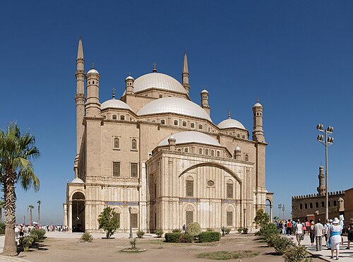
مسجد محمد علي
The Mosque of Muhammad Ali is a nineteenth-century Ottoman mosque situated within the Cairo Citadel complex in Egypt. Commissioned by Muhammad Ali Pasha, it is constructed largely of alabaster, earning it the popular name the Alabaster Mosque.
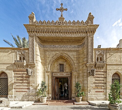
القاهرة القبطية
Coptic Cairo is a compact historic quarter in Old Cairo, Egypt. It contains significant religious and archaeological sites spanning multiple eras. The area includes ancient Christian churches, a synagogue, and traces of Roman settlement.
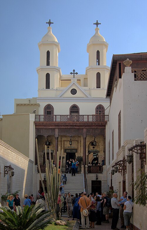
الكنيسة المعلقة
The Hanging Church, locally known as al-Kanīsa al-Muʿallaqa, is the Church of the Virgin Mary in Old Cairo. It was constructed above the gateway of a Roman fortress, giving it its distinctive elevated position.
Downtown centres on Tahrir Square and the nineteenth-century street grid. Zamalek occupies an island in the Nile and connects by bridge to Downtown and Giza. Historic Cairo includes Al-Muizz Street, mosques, gates and markets, while Coptic Cairo forms a separate southern cluster. The Giza pyramids and Grand Egyptian Museum lie west of the Nile. Saqqara and Memphis are farther excursions and should not be combined with a full central-city day.
Checked 2026-08-26
Metro, buses, metered taxis and ride-hailing services cover Greater Cairo, while Nile taxis and local ferries provide selected river connections. The official tourism authority advises ensuring a taxi meter is operating. Use the Metro for suitable cross-city corridors, then allow time for the final road journey. Giza, Saqqara and airport transfers require specific planning, and access to remote archaeological areas should be confirmed through authorised operators or official guidance.
Checked 2026-08-26
Downtown, Historic Cairo, Coptic Cairo, Zamalek and Giza are separate clusters
No fixed stay length is recorded; allocate time by cluster and by any archaeological excursion.
Use Metro where practical, then metered taxis, buses or ride-hailing for final connections.
Giza lies west of the Nile and needs a dedicated road or tour connection.
Selected Historic Cairo routes are walkable once you reach the area by planned transport.