Roavina

City guide · Serbia

Belgrade

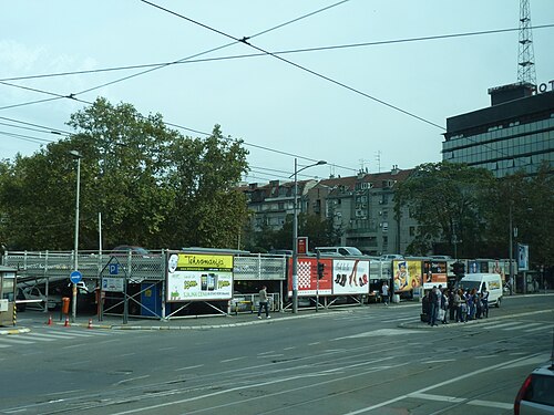
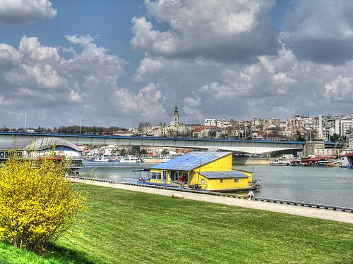
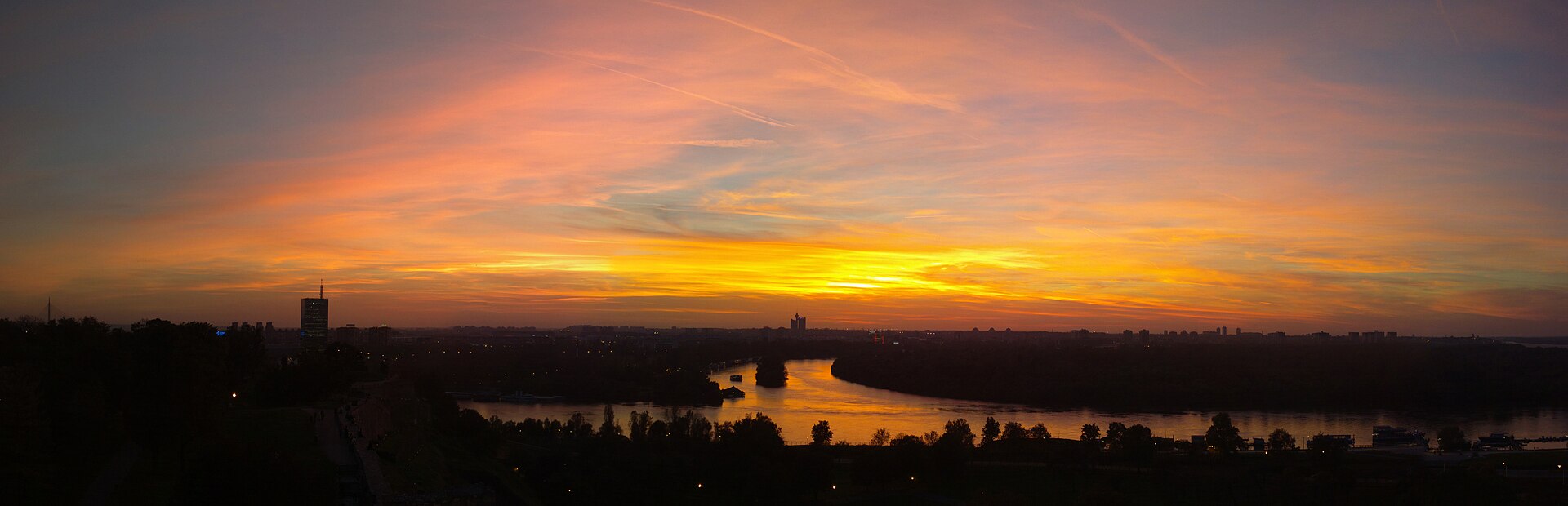
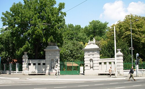
A photograph of Belgrade
Photograph · Vladimir Nolic · CC BY-SA 4.0

Belgrade is 389.12 km² holding 1,197,714 people, and it stands on the point where the Sava runs into the Danube. That confluence is why the city exists and why it has been fought over so relentlessly: it has been battled over in 115 wars and razed 44 times. The name Beograd means white city. The administrative area holds 1,682,720 people across 3,234.96 km² in 17 municipalities. The part a visitor uses is a fraction of that — the old town on the ridge above the rivers, and the streets running down from it.

Reviewed by Elena Voss · Roavina Travel Editor

Practical information

Language spoken
Serbian
Written in both Cyrillic and Latin; English is understood in tourist districts
Dialling code
+381 11
Belgrade landlines; drop the leading 0 of 011 when calling from abroad
Currency
Serbian dinar (RSD)
Euros are not accepted; cards are widely taken in Belgrade
Emergency number
112
One number across the country; 194 reaches an ambulance directly
Plug type
Type C and F · 230 V
Standard European two-pin
Tap water
Not recorded
No verified national source in the dataset

Turn this list into a plan

Set your days, your pace and the hours you actually want to be out. The planner works around closing days and travel time, and leaves room to eat.

Plan Belgrade

Planning a visit

Suggested stay
2–3 days
Getting around
Tram, bus and on foot
  1. January: viable with meaningful trade-offs
  2. February: viable with meaningful trade-offs
  3. March: good time to visit
  4. April: best time to visit
  5. May: best time to visit
  6. June: good time to visit
  7. July: viable with meaningful trade-offs
  8. August: viable with meaningful trade-offs
  9. September: best time to visit — current month
  10. October: best time to visit
  11. November: good time to visit
  12. December: viable with meaningful trade-offs
  • Best time
  • Good time
  • Viable with trade-offs
  • Difficult conditions

Sources

Top things to see

Ranked by importance — sitelinks, pageviews and heritage status, not editor preference.

  1. Topčider Topčider
    02 1 hour

    Topčider

    Топчидерски парк

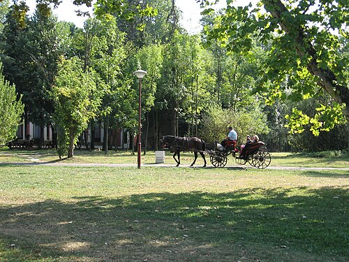
    Topčider is a forest park in Belgrade built around the country residence of Prince Miloš Obrenović, the ruler who founded modern Serbia.

    • Must see
    • Nature site
    • Savski Venac
  2. Great War Island Great War Island
    03 3 hours

    Great War Island

    ПИО Велико ратно острво

    Great War Island is an uninhabited river island at the point where the Sava flows into the Danube, inside Belgrade's Zemun municipality.

    • Must see
    • Nature site
    • Zemun
  3. Kalemegdan Park Kalemegdan Park
    04 1 hour

    Kalemegdan Park

    Калемегдан

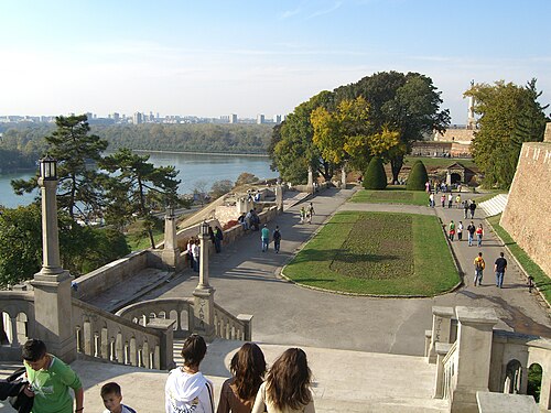
    Kalemegdan Park is the 53-hectare public park that wraps around Belgrade Fortress on a 125-metre-high cliff at the junction of the Sava and Danube rivers.

    • Must see
    • Nature site
    • Stari Grad
  4. Dedinje Royal Compound Dedinje Royal Compound
    05 2 hr 30 min

    Dedinje Royal Compound

    Краљевски комплекс

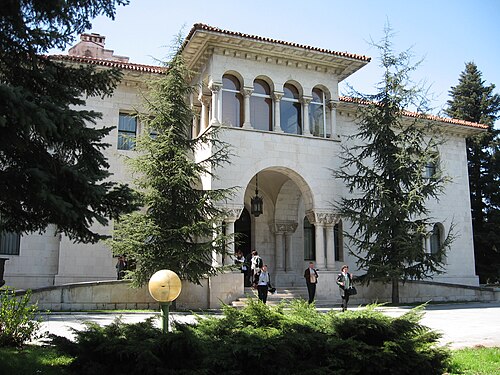
    The Royal Compound (Kraljevski kompleks) is the enclosed park in Dedinje, on the wooded ridge south-west of central Belgrade, that King Alexander I Karadordevic chose in the 1920s as the site for a new royal residence away from the old…

    • Must see
    • Nature site
    • Savski Venac
  5. Pioneers Park Pioneers Park
    06 1 hour

    Pioneers Park

    Пионирски парк

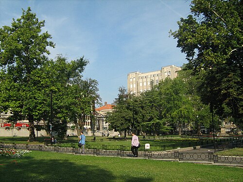
    Pioneers Park is a compact green space in central Belgrade between the Old Palace and New Palace. Its importance comes from this civic setting: lawns, planted areas and paths sit beside two prominent palace buildings in the capital’s administrative centre.

    • High
    • Nature site
    • Stari Grad
  6. Karađorđev Park Karađorđev Park
    07 1 hour

    Karađorđev Park

    Карађорђев парк

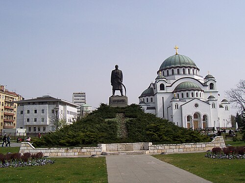
    Karađorđev Park is a memorial green space beside Bulevar oslobođenja, set between the National Library of Serbia and the Church of Saint Sava.

    • High
    • Nature site
    • Vračar
  7. Vračar plateau Vračar plateau
    08 1 hour

    Vračar plateau

    Врачарски плато

    Vračar plateau is an open civic and religious setting on one of Belgrade’s most recognisable hills.

    • High
    • Nature site
    • Vračar
  8. Topovske Šupe concentration camp Topovske Šupe concentration camp
    09 1 hour

    Topovske Šupe concentration camp

    Спомен-парк Топовске шупе

    Topovske Šupe was a German occupation camp in Belgrade that operated from August to November 1941. It held Jewish men from Belgrade, Smederevo and Banat, alongside Roma men from Belgrade.

    • High
    • Nature site
    • Voždovac
  9. Lido Lido
    10 1 hour

    Lido

    Лидо

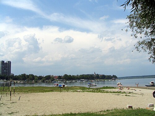
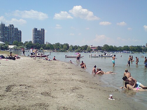
    Lido is Belgrade’s seasonal city beach on Great War Island, set across the Danube from Zemun. Its character comes from the combination of a sandy shore, river surroundings and a temporary summer connection from the Zemun riverfront.

    • High
    • Nature site
    • Zemun
  10. Park of Friendship Park of Friendship
    11 1 hour

    Park of Friendship

    Парк пријатељства

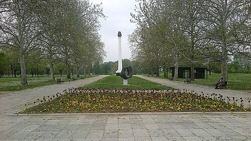
    Park of Friendship is a memorial park in Belgrade’s Ušće area, beside the Danube and Sava. Established in 1961, it combines diplomatic history with an open riverside landscape.

    • High
    • Nature site
    • New Belgrade
  11. Banjica Forest Banjica Forest
    12 1 hour

    Banjica Forest

    СП Бајфордова шума

    Banjica Forest is the local name for Byford’s Forest, or Bajfordova šuma, a protected natural monument in Belgrade’s Voždovac municipality. This public woodland is designated for sport and recreation, while its ecological importance comes from its rich birdlife.

    • High
    • Nature site
    • Voždovac
  12. Straževica
    13 20 min

    Straževica

    Стражевица

    Straževica is a hill in Belgrade’s Rakovica municipality and includes the outdoor memorial site known as “Glasnik sa Straževice.” This is a place of remembrance in a hillside landscape, not a conventional museum or enclosed sightseeing complex.

    • High
    • Viewpoint
    • Rakovica
  13. Academy Park Academy Park
    14 1 hour

    Academy Park

    Академски парк

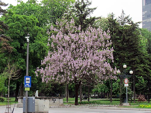
    Academy Park, also called Akademski Park, Studentski Park and Univerzitetski Park, is a compact historic green space on Studentski trg in Belgrade’s old city centre.

    • Notable
    • Nature site
    • Stari Grad
  14. City Park in Zemun City Park in Zemun
    15 1 hour

    City Park in Zemun

    Градски парк

    City Park in Zemun is a 7.72-hectare urban green space at the edge of Zemun’s old core, in Belgrade’s Donji Grad area.

    • Notable
    • Nature site
    • Zemun
  15. Zvezdara Forest Zvezdara Forest
    16 1 hour

    Zvezdara Forest

    Звездарска шума

    Zvezdara Forest is a protected urban woodland on the wooded part of Veliki Vračar, in eastern Belgrade’s Zvezdara municipality. Its protected area covers 80 hectares, 57 ares and 87 square metres, and its legal designation is natural monument.

    • Notable
    • Nature site
    • Zvezdara
  16. Crveni Krst Crveni Krst
    17 1 hour

    Crveni Krst

    Црвени крст

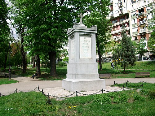
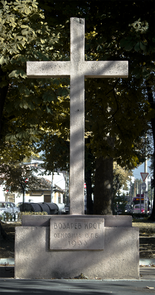
    Crveni Krst is a red artificial-stone cross in a small public park in Belgrade’s Vračar municipality, between Vojvode Šupljikca Street and Mileševska Street.

    • Notable
    • Nature site
    • Vračar
  17. Park Republika Srpska Park Republika Srpska
    18 1 hour

    Park Republika Srpska

    Парк Републике Српске

    • High
    • Nature site
    • New Belgrade
  18. Park Luka Ćelović Park Luka Ćelović
    19 1 hour

    Park Luka Ćelović

    Парк Луке Ћеловића

    • High
    • Nature site
    • Savski Venac
  19. Savski kej Savski kej
    20 1 hour

    Savski kej

    Савски кеј

    • High
    • Nature site
    • New Belgrade
  20. Nudist Beach Ada Ciganlija
    21 1 hour

    Nudist Beach Ada Ciganlija

    Нудистичка плажа Ада Циганлија

    • High
    • Nature site
    • Čukarica
  21. Pančićev park
    22 1 hour

    Pančićev park

    Панчићев парк

    • High
    • Nature site
    • Stari Grad
  22. Park Banovo brdo
    23 1 hour

    Park Banovo brdo

    Парк Баново брдо

    • High
    • Nature site
    • Čukarica
  23. Sava Park
    24 1 hour

    Sava Park

    Савски парк

    • High
    • Nature site
    • Savski Venac
  24. Slavujev potok
    25 1 hour

    Slavujev potok

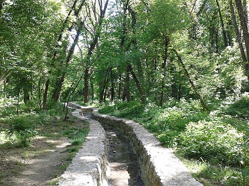
    Славујев поток

    • High
    • Nature site
    • Zvezdara
  25. The Honey Garden
    26 1 hour

    The Honey Garden

    Медоносни врт

    • High
    • Nature site
    • Stari Grad
  26. Petlovo Brdo
    27 20 min

    Petlovo Brdo

    Петлово брдо

    • High
    • Viewpoint
    • Čukarica
  27. Crveni park
    28 1 hour

    Crveni park

    Црвени парк

    • Notable
    • Nature site
    • Vračar

Source: OpenStreetMap contributors, Wikidata ·

More city guides

Where to base yourself

District boundaries come from OSM administrative relations, so a district page holds exactly the places inside it — plus, for the islands and the coast, the nearest district by proximity.

  • Stari Grad

    Places
    571
    Across the district
    35 min
  • Savski Venac

    Places
    222
    Across the district
    1 hr 24 min
  • New Belgrade

    Places
    184
    Across the district
    2 hours
  • Vračar

    Places
    135
    Across the district
    40 min
  • Zemun

    Places
    127
    Across the district
    4 hr 56 min
  • Palilula

    Places
    131
    Across the district
    7 hr 42 min
  • Zvezdara

    Places
    116
    Across the district
    1 hr 48 min
  • Čukarica

    Places
    95
    Across the district
    3 hr 6 min
  • Voždovac

    Places
    87
    Across the district
    4 hr 29 min
  • Rakovica

    Places
    60
    Across the district
    1 hr 55 min

How the city is laid out

Two Belgrades, split by the Sava.

Old Belgrade sits on the ridge on the right bank, above the confluence. The fortress is at the point; Stari Grad, the old town, runs back from it; Vračar rises behind that with the Church of Saint Sava on top; Dorćol drops north towards the Danube and Savamala south towards the Sava.

New Belgrade is on the left bank of the Sava, built from 1948 onward on empty ground to demonstrate that Yugoslavia was at the forefront of progress. It is towers and boulevards on a grid and it is a different city.

Zemun, further up the Danube on the left bank, was a separate town under Austria-Hungary until the twentieth century and still reads as one — low houses, a hill with a tower, and the border of an empire running through it.

Checked 2026-08-23

Getting around

Trams, buses, trolleybuses and walking. There is no metro.

A metro has been discussed for decades and is not in operation; anyone reading about the Belgrade metro is reading about a construction programme, not a way to get across the city today.

The old town is compact and the walk from the fortress to the Church of Saint Sava takes about half an hour, all of it through the parts a visitor came for. New Belgrade and Zemun need transport.

Taxis are cheap by western European standards and are the usual way across the river at night.

Checked 2026-08-23

Common questions

How many days does Belgrade need?

Two to three. Two cover the fortress, Kalemegdan, the old town and the Church of Saint Sava. A third adds Zemun on the Danube and a look at New Belgrade.

Is there a metro?

No. Belgrade runs trams, buses and trolleybuses, and a metro has been discussed for decades without entering service. The old town is walkable and taxis are cheap.

What does Beograd mean?

White city. The name is literal.

Why is the city so scarred?

It stands where the Sava meets the Danube, which made it the frontier between empires. It has been fought over in 115 wars and razed 44 times.

What is the difference between Old and New Belgrade?

The Sava. Old Belgrade is the ridge above the confluence with the fortress at its point. New Belgrade is on the left bank, built from 1948 on empty ground as a demonstration of Yugoslav modernity.

Which districts should I stay in?

Stari Grad for the old town, Vračar behind it for a quieter residential base, Dorćol towards the Danube and Savamala on the Sava for the nightlife. Zemun is a separate town in feel and is further out.